Driving the Ruta de los Salares in Chile looks simple on a map, but the best part is knowing where to stop before the road carries you all the way toward the border.
Ruta de los Salares was the final self-drive day trip we saved for the end of our Atacama stay. By then, Bill and I had already worked our way up through several easier drives, which made this paved route toward the Bolivia and Argentina borders feel like the right grand finale.
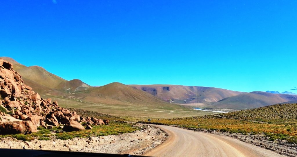
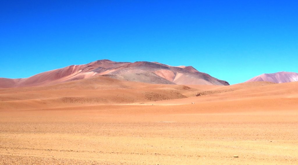
Ruta 27 felt like a slow reveal: volcano viewpoints first, then green wetlands, mirror-like lagoons, white salt flats, and volcanic mountains striped in rust, pink, and gold. The miradors (viewpoints) offered dramatic scenery and the lagunas (lagoons) were filled with wildlife.
I’ll show you where we stopped, which viewpoints were worth pulling over for, and how far I would drive before turning around.
Quick Overview
- Driving time: About 3-1/2 hours, not including stops
- Total time: 5-6 hours
- Road conditions: Ruta 27 is paved for the entire drive, with a few rough patches, curves, and long straight stretches
- Highest elevation: Highest elevation: About 14,764 feet / 4,500 meters at Mirador Quebrada Quepiaco
- Admission required: None for the roadside viewpoints and lagoons we visited
- Best for:
- Dramatic high-altitude scenery
- Salt flats, lagoons, and wetlands
- Vicuñas, flamingos, and other wildlife
- Travelers who want a fully paved self-drive route
- A paved high-Andes drive saved for later in your trip

Google Maps Stops
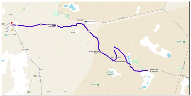
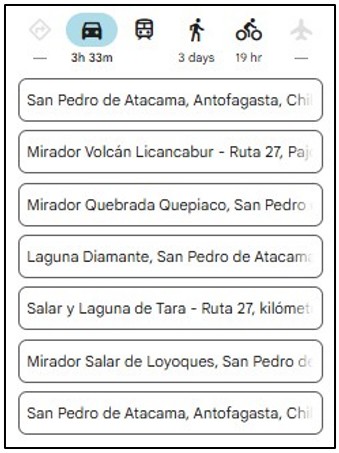
Enter these stops in order:
- San Pedro de Atacama
- Mirador Volcán Licancabur
- Mirador Quebrada Quepiaco
- Laguna Diamante
- Salar y Laguna de Tara
- Mirador Salar de Loyoques
- San Pedro de Atacama
The final viewpoint may also appear as Salar de Quisquiro. The roadside sign used that name, while Google Maps identified it as Mirador Salar de Loyoques.
Download the route before leaving town and save screenshots to your phone. Cell service becomes unreliable, and the stops are spread across a remote stretch of Ruta 27.
Planning to self-drive the Atacama too? We booked our rental SUV through DiscoverCars.com because it made comparing prices and vehicle options from multiple rental companies quick and easy.

Driving Notes for the Ruta de los Salares
- San Pedro de Atacama to Volcán Licancabur: About 30 minutes – The first viewpoint is on the right side of the road, about 400 meters BEFORE the location shown on Google Maps. Start watching for the pullout early.
- Volcán Licancabur to Quebrada Quepiaco: About 35 minutes
- Quebrada Quepiaco to Laguna Diamante: About 5 minutes
- Laguna Diamante to Salar y Laguna de Tara: About 25 minutes
- Salar y Laguna de Tara to Salar de Loyoques: About 15 minutes
- Salar de Loyoques back to San Pedro de Atacama: About 1 hour, 45 minutes
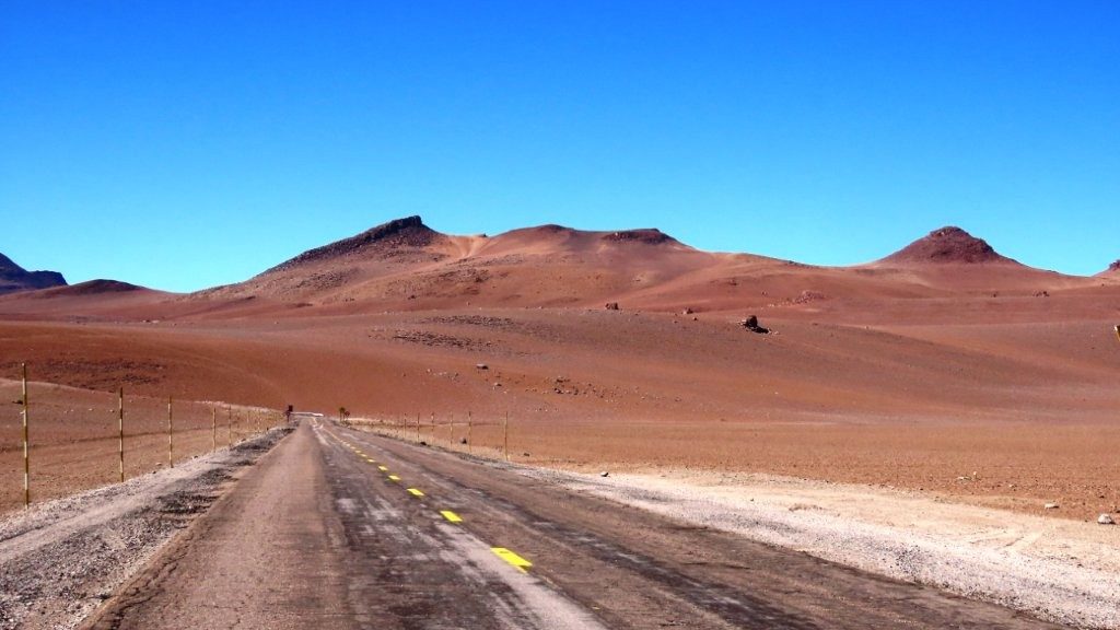
The drive is straightforward compared with the rougher Atacama routes because Ruta 27 is paved the whole way. You’ll head east out of San Pedro de Atacama and climb steadily into the Andes Mountains.
Tickets & Reservations
We did not need tickets or reservations for any of the roadside stops on our Ruta de los Salares drive. The viewpoints and lagoons we visited were accessible directly from Ruta 27, either from designated pullouts with parking lots, or safe roadside shoulders.
Also note, there were no restrooms available at any of our stops.

PLAN YOUR TRIP WITH OUR
FAVORITE TOOLS
– Best Lodging site: Booking.com
– Book Day Tours here: Viator.com
– Rent Cars here: DiscoverCars.com
Our Experience Driving the Ruta de los Salares
Ruta 27 Felt Like a Slow Reveal
This was one of the most visually varied and dramatic drives we took in the Atacama Desert, but it unfolded differently than the others.
Ruta 27 stayed paved and easy to follow, so the surprise came from what appeared beside the road: volcano views, red plateaus, green wetlands, open lagoons, and pale salt flats.
Traffic was extremely light, so when I spotted an interesting landscape or animal, we could usually pull over safely and take photos.
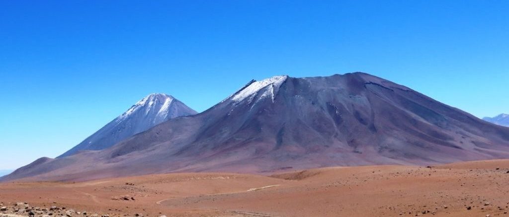
Mirador Volcán Licancabur
Our first stop gave us a clear view of Licancabur Volcano rising above the desert.
The Mirador (viewpoint) was easy to miss because it appeared before the location marked on Google Maps. We found the pullout on the right about 400 meters early.
Licancabur is visible from many places around San Pedro de Atacama, but seeing it from Ruta 27 gave us a different perspective. The surrounding terrain felt wider, emptier, and much more remote.
Mirador Quebrada Quepiaco
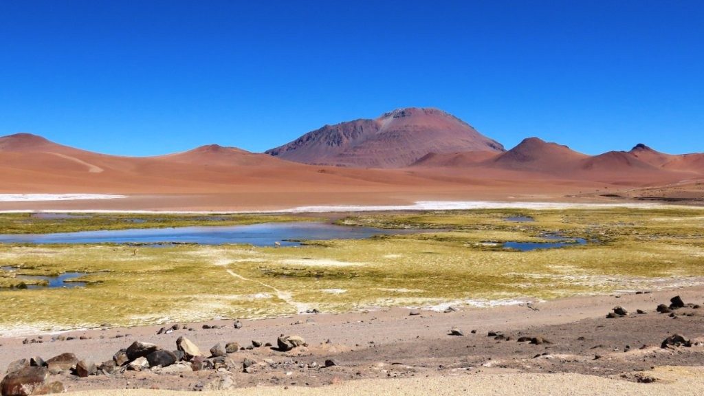
Mirador Quebrada Quepiaco sits at about 14,764 feet or 4,500 meters.
After miles of dry desert, the green wetland looked almost unreal. Shallow water wound through bright grass while vicuñas grazed across the open landscape.
We also saw Andean Flamingos, Andean Avocets, Andean Geese, and Crested Ducks in the wetland. Many of the birds were similar to those we had already seen around Machuca and Vado Río Putana, but the setting was completely different.
The viewpoint is directly beside the road, so we did not need to hike. That made it an easy stop to enjoy slowly, especially since the viewpoint is already high enough that I did not want a real hike.
Laguna Diamante
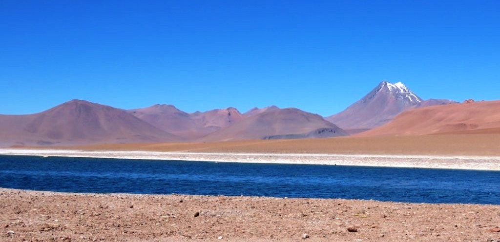
Laguna Diamante sits at roughly the same elevation as Quepiaco, but it feels much more open.
Instead of narrow wetland channels, we found a broader expanse of water surrounded by pale mineral ground and volcanic hills.
This was one of the easiest places to linger because the lagoon sits right beside Ruta 27. It also gave us some of the best bird sightings of the drive, including Horned Coots, Slate-colored Coots, Baird’s Sandpipers, Silvery Grebes, and Crested Ducks.
This was one of the easiest places to linger because the lagoon sits right beside Ruta 27.
Baby Vicuñas and Our First Culpeo Fox
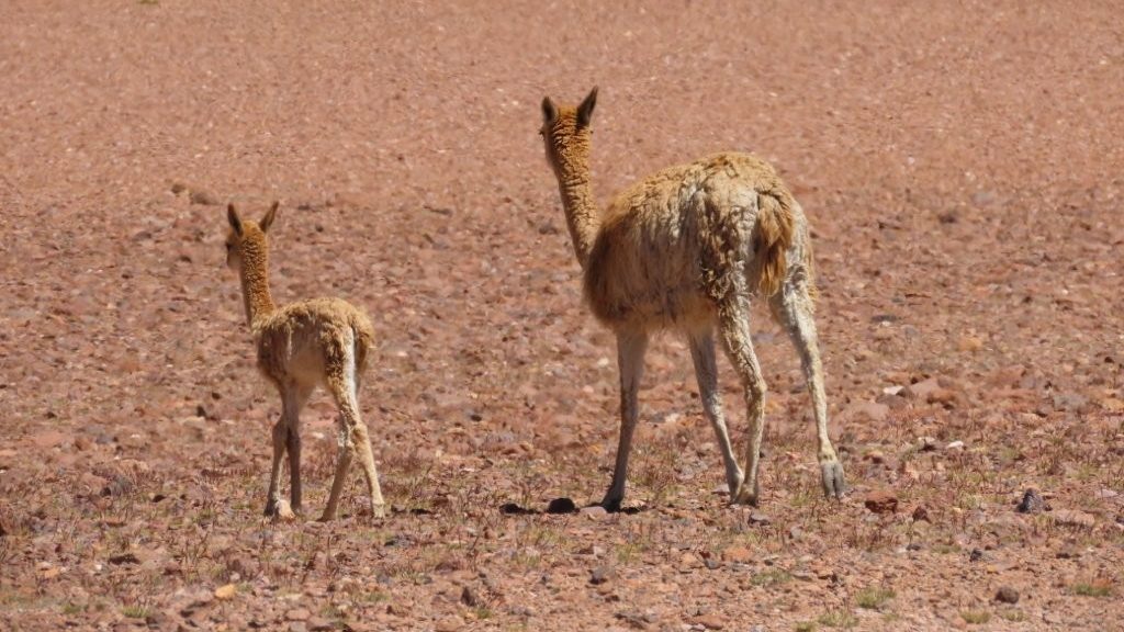
We had already seen vicuñas during our drive to Machuca Wetlands, but Ruta de los Salares gave us some of our closest sightings.
Several vicuñas grazed near the road, including mothers with babies. The young ones looked especially tiny against the enormous volcanic landscape.
Then we finally spotted a Culpeo Fox.
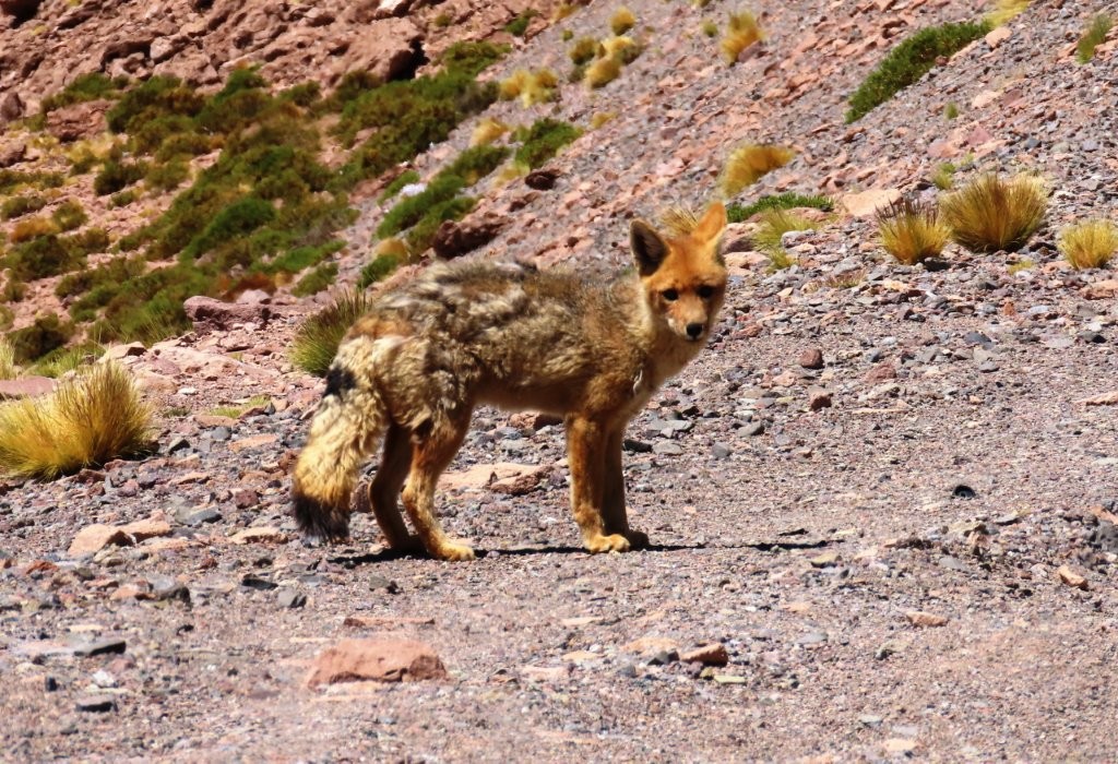
It stood on the rocky roadside and watched us long enough for me to hop out of the car and take photos. We had hoped to see one during our Atacama stay, so finding it on our final major drive felt like a gift.
Wildlife sightings will always vary, but keeping our own schedule gave us time to slow down whenever something appeared.
Seeing baby vicuñas and our first Culpeo Fox was a highlight of our Atacama Desert trip. I share more of the animals we encountered—and where we found them—in my Atacama Desert Animals guide.
Salar y Laguna de Tara
Salar y Laguna de Tara sits at about 14,107 feet or 4,300 meters.
The landscape became broader and more mineral here, with shallow water, pale salt deposits, and red-brown mountains stretching across the horizon.
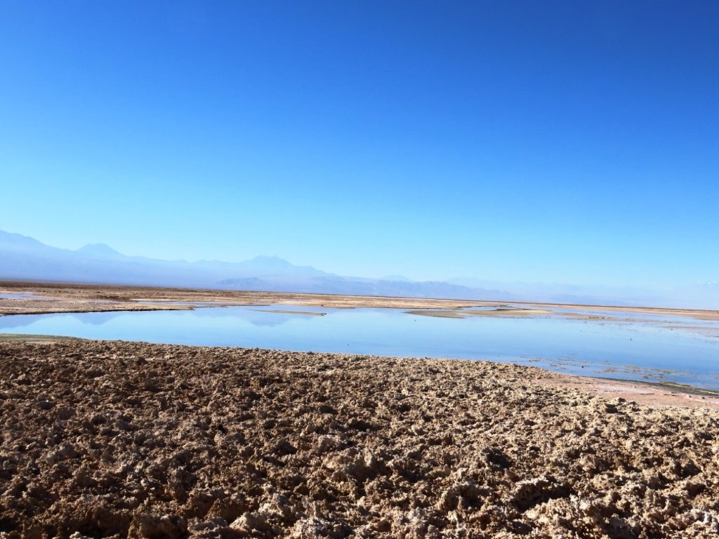
At the stop, I talked to a woman from the Czech Republic traveling by motorcycle from Argentina toward Bolivia. Encounters like that were rare on our quieter Atacama drives, and it reminded me how close we were to the international borders.
Mirador Salar de Loyoques
Mirador Salar de Loyoques was our final stop. The roadside sign called the area Salar de Quisquiro, which may be the name you see used elsewhere. It sits at approximately 13,615 feet or 4,150 meters.
This viewpoint felt more like a classic salt-flat landscape than the wetlands we had seen earlier. White mineral bands curled around shallow pools, and muted red hills rose in the distance.
We saw fewer birds here, but I did spot a Plumbeous Sierra Finch moving among the rocks. It was a quieter birding stop than Quepiaco or Laguna Diamante, but still worth watching carefully.
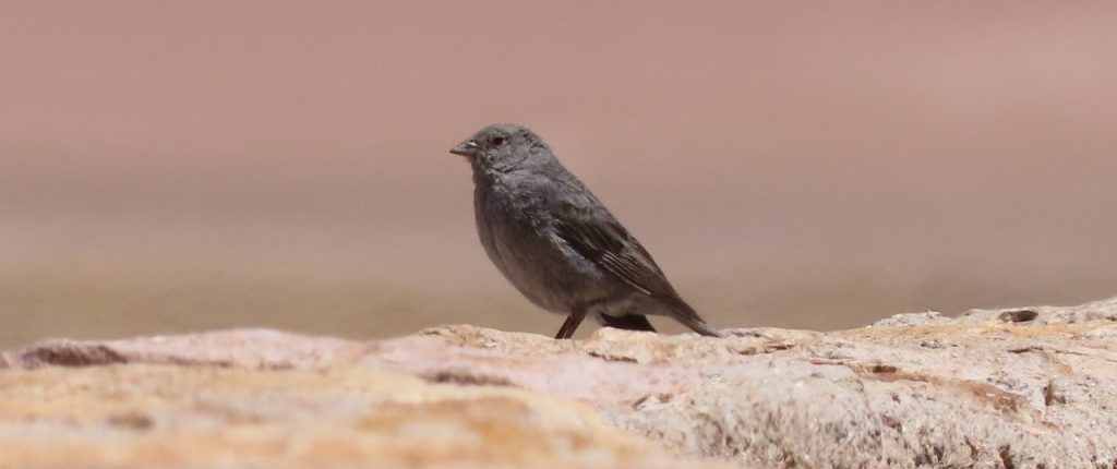
After taking photos, we turned around and headed back toward San Pedro.
This was our last stop before reaching the Argentina border. You need special paperwork to cross an international border with a rental car, and although we had crossed from Chile to Argentina twice in Patagonia, we did not want to do it here.
Why We Saved This Drive for Last
This was the highest elevation drive of our Atacama stay, which is exactly why we saved it for last.
None of the stops required difficult hiking, but several hours between roughly 13,600 and 14,800 feet still makes this a day to plan thoughtfully. We moved slowly, kept the route flexible, and turned around at Mirador Salar de Loyoques instead of pushing farther toward the Argentina border.
For us, that was the right call. Returning to San Pedro felt easier with every mile we descended.
If you are deciding when to tackle drives like this, my Atacama Desert Altitude guide explains the gradual progression we followed.
Kari’s Tips for This Drive
- Fill your gas tank before leaving San Pedro de Atacama. The COPEC station is only gas station in town and is located on the corner of Ruta 27 and Hwy B-241.
- Download Google Maps and save screenshots before you lose service.
- Watch for Mirador Volcán Licancabur about 400 meters before the map pin.
- Give wildlife plenty of space and stay near the road.
- Pull over only where the shoulder is wide and visibility is clear.
- Carry water, snacks, sunscreen, and layers.
- Expect the temperature to change quickly at high elevation.
- Plan for no restrooms along the route and bring toilet paper with you. (hint, I finally peed crouched down behind a stone wall at one of the stops)
- Save this drive for later in your Atacama stay if you are still adjusting to the elevation.
- Choose your turnaround point before you feel tired. The return drive is still long.
Would We Drive the Ruta de los Salares Again?
Yes. I would still save Ruta de los Salares for the end of an Atacama trip, but I would absolutely drive it again.
Ruta de los Salares gave us some of the most varied scenery of our entire Atacama stay. We saw wetlands, open lagoons, salt flats, volcanoes, baby vicuñas, flamingos, and our first Culpeo Fox—all along a paved road that was easy to follow.
The main thing I would remember is that a paved road does not make this a casual low-effort day. It is still a high-Andes drive, and I would keep the same flexible turnaround plan.
Still, this was a perfect final drive for our time in the Atacama Desert. Ruta 27 gave us volcanoes, lagoons, salt flats, baby vicuñas, and our first Culpeo Fox without needing to leave the paved road.
When I’d Take a Tour Instead
I would take a tour if I wanted to leave the driving to someone else in the high altitudes and learn more about what I was seeing. A guided Ruta de los Salares tour may include off-road areas, additional geological formations, and stops that require local access knowledge.
- Why go: Explore beyond the roadside viewpoints without having to navigate remote tracks on your own.
- Good to know: Tours operate at very high elevation, and the itinerary may change because of weather, road conditions, or access restrictions.
- Why pick this tour: This is the better option if you want a deeper Salar de Tara experience with a knowledgeable guide, rather than a self-drive along Ruta 27.
More Atacama Desert Travel Guides
Here are some more guides about visiting the Atacama Desert and Chile. If you’d like to receive emails when I’ve posted new content to the site, please complete the short form above.
Visit the Atacama Desert: A Self-Drive Guide
Atacama Desert Tours: How to Explore It Without Driving
Atacama Desert Map: Explore The Desert, One Road At A Time
Atacama Desert Altitude – How To Keep It From Ruining Your Trip
Atacama Desert Night Sky: How to Experience the Stars
Atacama Desert Animals: What You Can See & Where
Where to Stay in the Atacama Desert: My Top Hotel Picks for Every Budget
Day Trip #1 – West: Valle De La Luna Atacama + Magic Bus + Ckari Sunset
Day Trip #2 – South: Laguna Chaxa Flamingos + Valle de Jere
Day Trip #3 – Northwest: Rainbow Valley Atacama + Petroglifos Yerbas Buenas
Day Trip #4 – North: Machuca Wetlands + Vado Rio Putana
Day Trip #5 – East: Ruta de los Salares
