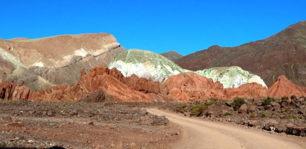
We came to see northern Chile’s Rainbow Valley. Then Google Maps sent us down several interesting “roads” that Bill wasn’t convinced were really actual roads.
We came for the colors at Rainbow Valley, but the drive turned into just as much of an adventure. We followed questionable-looking roads, crossed a riverbed several times, met wild donkeys that came right up to our car, and learned the hard way that Petroglifos Yerbas Buenas is much better with a guide.
If you are renting a car in San Pedro de Atacama, Rainbow Valley Atacama—Valle del Arcoiris in Spanish—makes a memorable self-drive day trip once you are comfortable with remote roads and higher elevation.
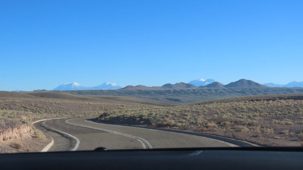
Our friends Stephanie and Ron had recommended driving Route B-207, and I am glad they did. This drive felt more remote than it looked on the map. Once we left the main highway, cell service faded, road signs became rare, and Google Maps sent us onto roads that did not always look like roads.
Quick Overview
- Driving time: About 2 hours 40 minutes total
- Total time: 5-6 hours
- Road conditions: Paved Ruta 23 and B-207, followed by unpaved local roads, a dry riverbed road, and several shallow water crossings
- Highest elevation: About 10,000-11,500 feet / 3000-3500 meters
- Admission required:
- Rainbow Valley (purchased onsite for cash)
- Petroglifos Yerbas Buenas (purchased onsite for cash)
- Best for:
- Colorful desert landscapes
- Photographers
- Wildlife sightings along the drive
- Travelers comfortable with remote roads and limited signage
- Visitors who have already spent time acclimating to the altitude
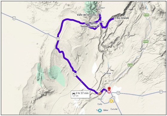
Save both maps to your phone: the full route from San Pedro and the zoomed-in version showing Rainbow Valley, Yerbas Buenas, and Río Grande.
Once you leave the main highway, there are almost no road signs. At one point, Google Maps told us to turn left onto what looked like a mowed-down farm road.
Bill looked at it and said, “Really? Are you sure? Is that even a road?”
He is normally game for just about anything, so the fact that he hesitated says a lot. We took the turn anyway, and it eventually brought us to Rainbow Valley.
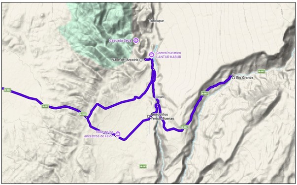


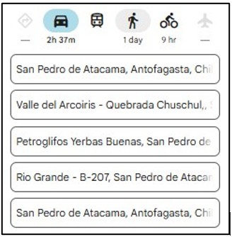
Google Maps Stops
Enter these stops in order:
- Valle del Arcoiris – Quebrada Chuschul
- Petroglifos Yerbas Buenas
- Río Grande – B-207
Still need a rental car? We found ours through DiscoverCars.com, which let us compare multiple rental companies in one place before we arrived in northern Chile.
Driving Notes for Rainbow Valley + Petroglifos Yerbas Buenas
- San Pedro de Atacama to Rainbow Valley: About 1 hour, 15 minutes – Ruta 23 and B-207 are fully paved. The Rainbow Valley entrance road is unpaved but in decent condition for most of the way.
- Rainbow Valley to Yerbas Buenas using the riverbed route: Approximately 4 kilometres – 15 minutes. We crossed the riverbed about six times – three of the crossings had a small amount water; only one felt a little deeper during our March visit
- Yerbas Buenas to the town of Río Grande: Google Maps says 13 minutes, but the narrow, cliff-hugging road had occasional boulders to navigate around. We drove slowly, and it took us closer to 30–40 minutes.
- Río Grande back to San Pedro de Atacama: Retrace B-207 and return to Ruta 23 – takes just over an hour.
Once you leave the main highway, signs are scarce and the roads become less obvious. The roughest section is the 4-kilometer riverbed route between Rainbow Valley and Yerbas Buenas. If there has been recent rain, return to B-207 instead. At the end of the riverbed road, turn right for Yerbas Buenas and left for Río Grande.
Tickets & Reservations
We paid at the entrances to both Rainbow Valley and Petroglifos Yerbas Buenas.
Bring Chilean pesos in smaller denominations. Paying by credit card is not an option at either of these places. Both sites preferred small bills because making change was difficult. The man behind me in line finally made change from his own wallet. Thank you, random stranger!
Our Experience Driving to Rainbow Valley Atacama & Yerbas Buenas
We left early in the morning because Rainbow Valley Atacama was about 75 minutes north of where we were staying.
Getting to Rainbow Valley
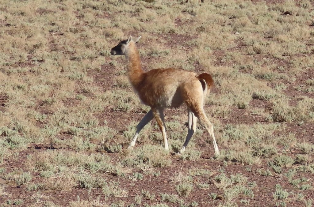
The drive along B-207 became interesting as soon as we left the more obvious roads behind. We saw guanacos, questionable turnoffs, and long stretches where we were relying almost completely on our saved map.
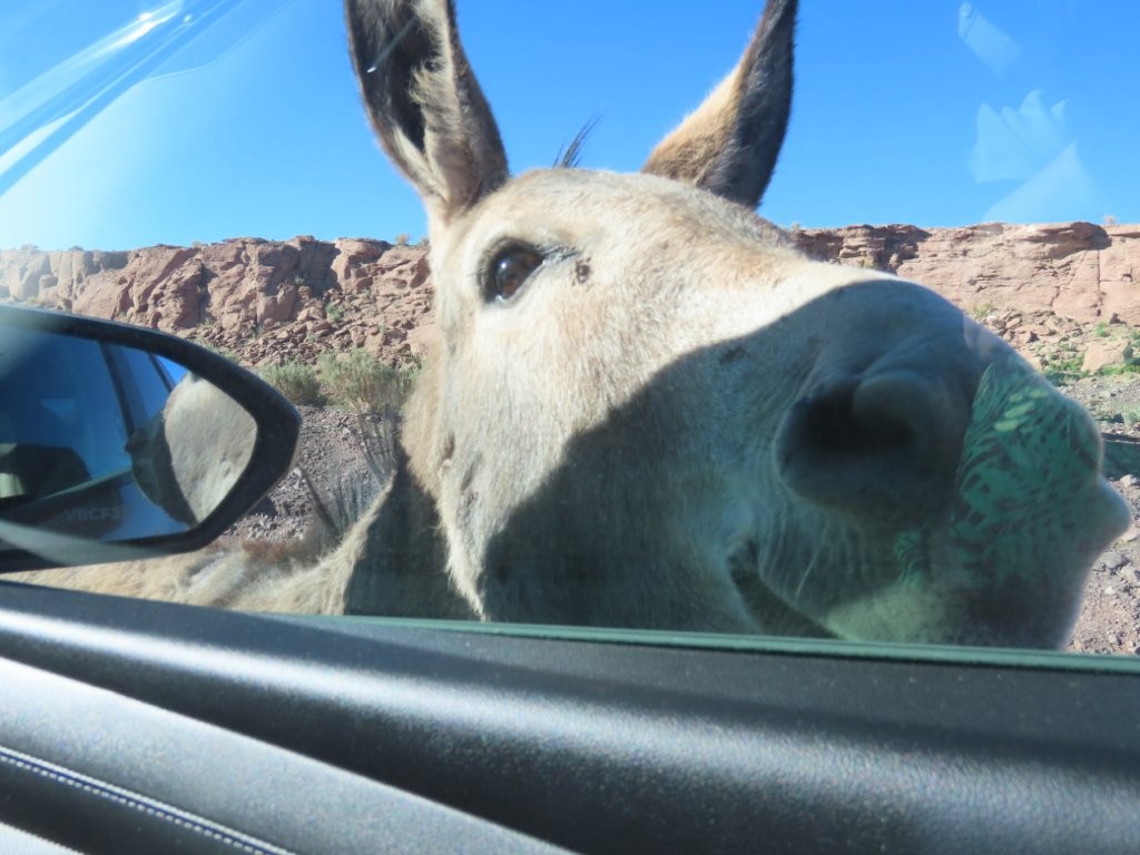
We also ran into some wild (feral) donkeys. At first, four of them walked toward us along the dirt road. One came right up to the car window and pushed its face close to the glass, clearly expecting food. I am glad the window was closed because that donkey was very determined!
Rainbow Valley
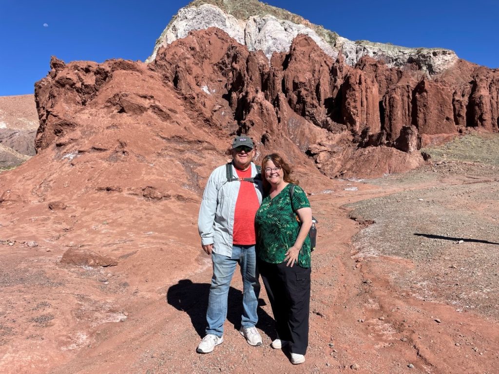
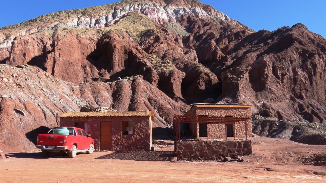
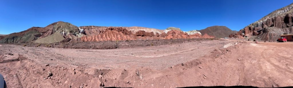
Finally, we reached the stunning Rainbow Valley Atacama.
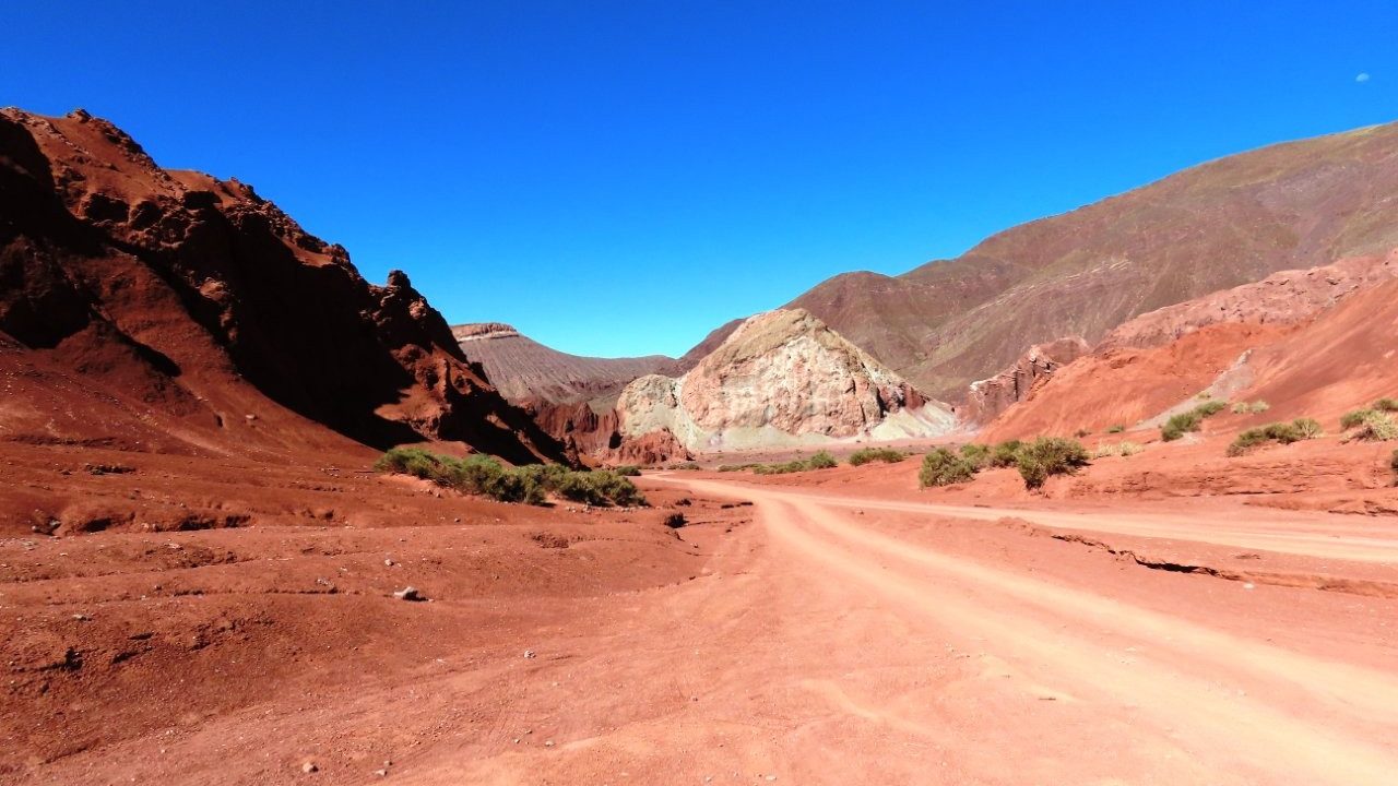
After paying at the ranger station, we drover a little deeper into the valley and parked where all the tour buses were parked. We started with the main 1.5-kilometer hiking trail. The route was mostly easy, but there were two short, steeper sections.
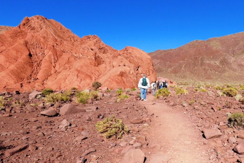
The trail itself was short, but we still took it slowly. At around 11,000 feet, even a modest walk felt different than it would have near San Pedro. If you are still planning the order of your day trips, my Atacama Desert Altitude Guide explains how we worked up to higher drives like this.
The valley is not filled with bright rainbow stripes in the way the name might suggest. The colors are more earthy and layered—deep rust red, pale green, cream, white, yellow, gray, and touches of lavender.
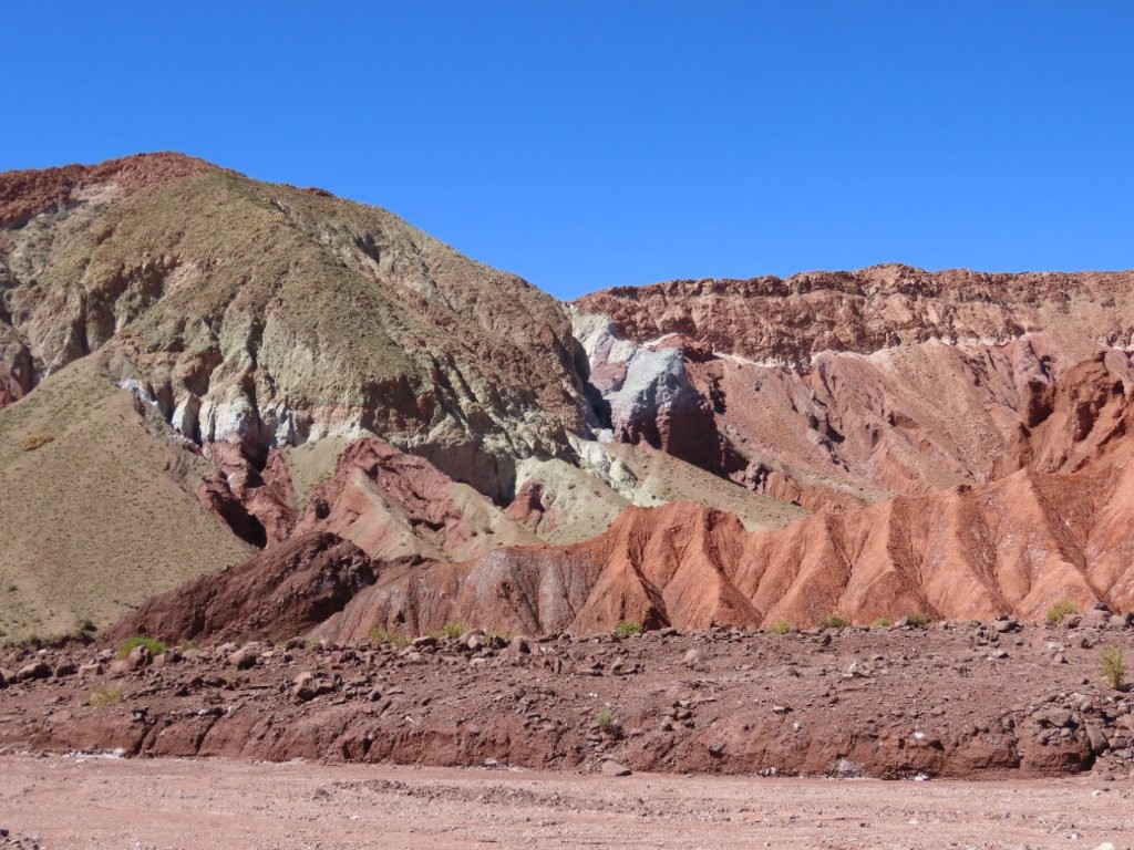
Some formations looked like completely different colors had been painted onto the mountains and pushed together. The shades come from minerals exposed by erosion, but I did not need to understand all the geology to appreciate the contrast.
The trail was not well marked, so we followed a tour group that seemed to know where it was going. Or at least we assumed that their leader did!
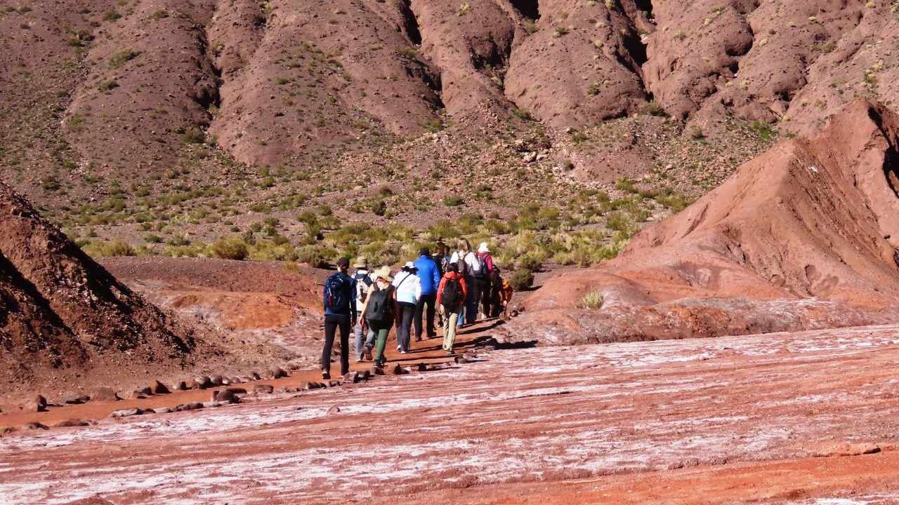
After the main trail, we got back into the car and drove deeper into Rainbow Valley to two additional stopping areas.
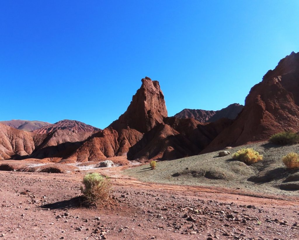
The landscape continued to evolve and change as we drove. At the first endpoint, the slot-canyon trail began with a roughly two-foot high first step – I’m pretty short and after 10 minutes of trying, I couldn’t figure out how to get my body up there – so I turned back.
Bill was already waiting in the car, and I decided this was not the place to push it. At the second stop, I only got out long enough to take photos before we continued toward Yerbas Buenas.
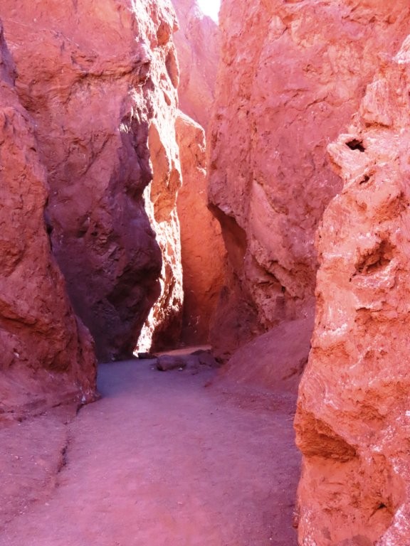
At the second stop, I only got out long enough to take photos. By then, the altitude had already taken enough energy out of both of us.

PLAN YOUR TRIP WITH OUR
FAVORITE TOOLS
– Best Lodging site: Booking.com
– Book Day Tours here: Viator.com
– Rent Cars here: DiscoverCars.com
Heading to Yerbas Buenas
From Rainbow Valley, we decided to take the short road toward Yerbas Buenas.
Calling it a road is generous—it follows a mostly dry riverbed. We crossed it about six times; three crossings had water, and only one made us pause. It was manageable in March, but I would not attempt it after recent rain or without 4WD.
When we reached the end, we were not sure which direction to go because there was no cell signal and almost no signage (which is why I suggest taking a screen shot of the map and saving it as a photo).
So we went left. That took us along the B-207 to the small town of Río Grande instead of Yerbas Buenas.
Río Grande was quiet and extremely remote, but the last five kilometers were beautiful—narrow, curving, and pressed between steep cliffs. We drove cautiously and occasionally had to weave around boulders in the road.
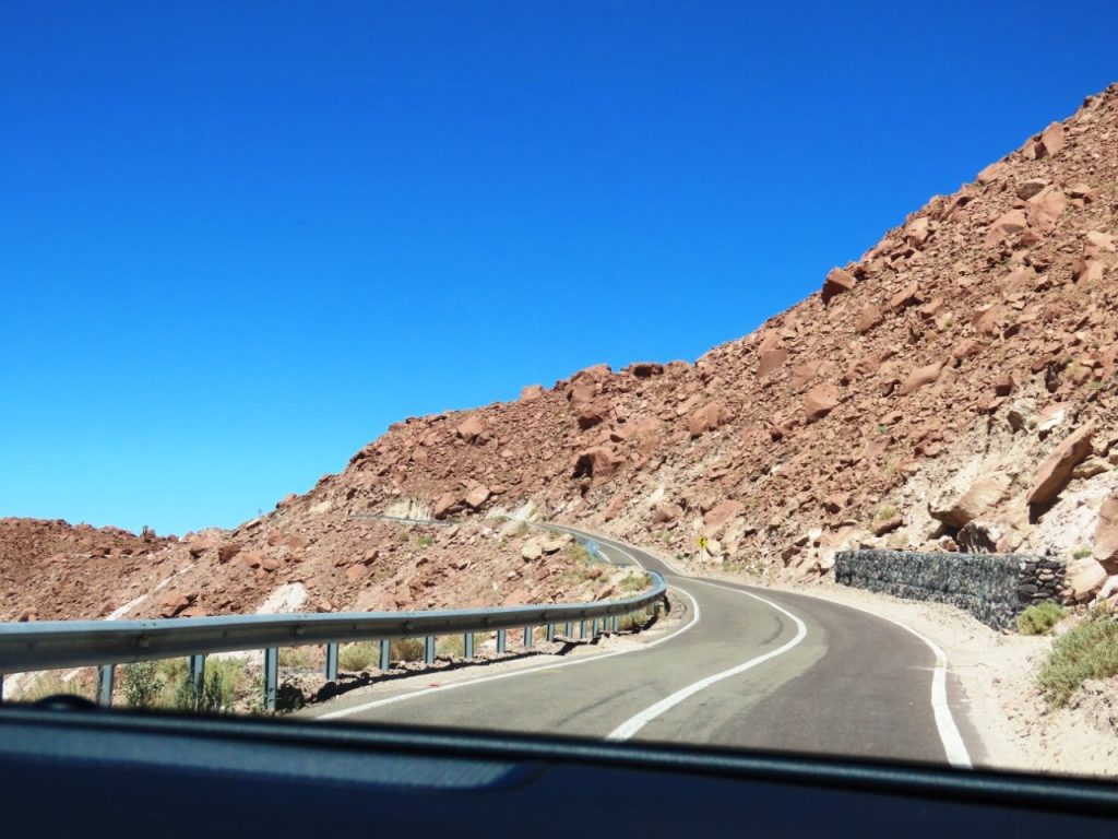
After realizing Yerbas Buenas was in the opposite direction, we retraced our route.
Petroglifos Yerbas Buenas
At Petroglifos Yerbas Buenas, I paid the admission fee and wandered among the rock formations for a while. This is where I made the biggest mistake of the day.
I went in without a guide.
There was no map available and almost no signage, so I could not tell whether I was looking at ancient rock art or natural discoloration. The rocks were interesting, and small birds darted between them, but I left feeling like I had missed the point of the site.
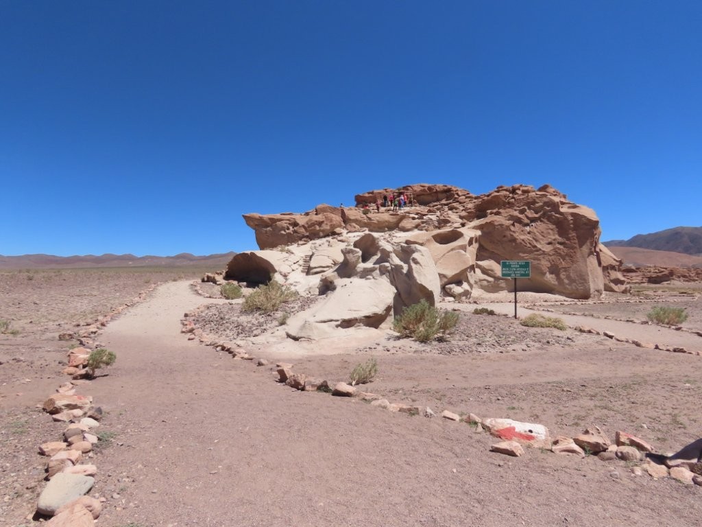
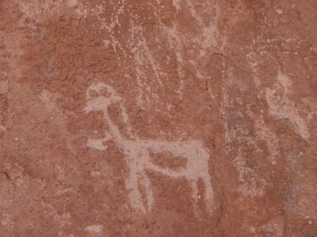
Is this a petroglyph? or just some scratches? I had no idea.
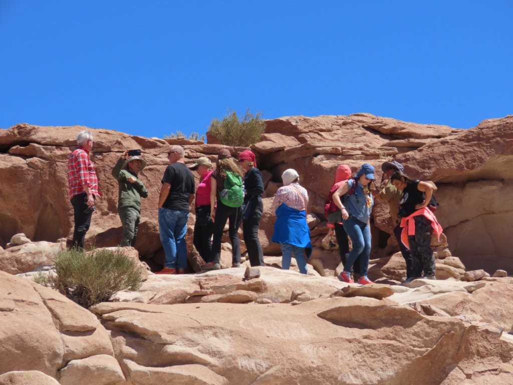
These people were smart. They came with a tour guide who explained what the petroglyphs were and what they were seeing.
The elevation at Yerbas Buenas did not bother me as much as at Rainbow Valley, but there was more climbing and scrambling than I expected. I would skip it if you have mobility concerns.
After that, we drove back to San Pedro de Atacama. Along the way, I spotted the only bird of prey we saw in the Atacama Desert, the Mountain Caracara. I hopped out to take a few photos before he flew away.
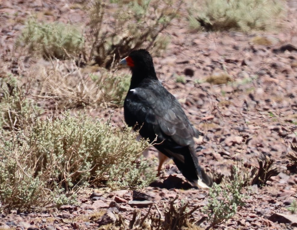
Once you’ve completed this drive, you are ready to tackle some of the higher elevation drives like the Machuca Wetlands or the Ruta de los Salares.
Kari’s Tips for This Drive
- One drives, one navigates. Even with Google Maps loaded on Apple Car-Play, it’s easy to miss some of the unexpected turns if you aren’t paying attention. The driver needs to stay focused on driving so having someone else navigate is super helpful!
- Download Google Maps before leaving Wi-Fi, then save screenshots of both the full route and the zoomed-in local roads.
- Bring small Chilean bills. Neither site accepted credit cards, and making change was difficult.
- Fill the gas tank before leaving San Pedro de Atacama.
- Bring water, sunscreen, sunglasses, a hat, and sturdy shoes.
- Take the main Rainbow Valley trail slowly. It is short (1.5km), but the elevation may make it feel harder than the distance suggests.
- Do not use the riverbed shortcut after recent rain.
- Only visit Yerbas Buenas with a guide arranged in advance. There are no guides waiting at the site.
Would We Drive to Rainbow Valley Again?
Yes, I would drive to Rainbow Valley Atacama again.
The questionable roads, guanacos, feral donkeys, colorful valley, and accidental detour to Río Grande made this one of the more memorable drives we took from San Pedro de Atacama.
I would still walk the main trail and drive to the extra viewpoints, but I would skip the slot-canyon climb. I would also only return to Yerbas Buenas with a guide.
When I’d Take a Tour to Rainbow Valley and Yerbas Buenas Instead
A tour makes the most sense if Yerbas Buenas is important to you. A guide can point out carvings you might otherwise miss and explain what they mean. Most tours that include the Petroglyphs also include Rainbow Valley since they are so close to each other.
So taking a tour also removes the stress of poorly marked roads, no cell service, and uncertain river crossings.
If I returned, I would either self-drive Rainbow Valley and skip Yerbas Buenas, or I’d book this guided tour that includes both: 6-hour tour to Valle del Arcoíris
More Atacama Desert Travel Guides
Here are some more guides about visiting the Atacama Desert and Chile. If you’d like to receive emails when I’ve posted new content to the site, please complete the short form above.
Visit the Atacama Desert: A Self-Drive Guide
Atacama Desert Tours: How to Explore It Without Driving
Atacama Desert Map: Explore The Desert, One Road At A Time
Atacama Desert Altitude – How To Keep It From Ruining Your Trip
Atacama Desert Night Sky: How to Experience the Stars
Atacama Desert Animals: What You Can See & Where
Where to Stay in the Atacama Desert: My Top Hotel Picks for Every Budget
Day Trip #1 – West: Valle De La Luna Atacama + Magic Bus + Ckari Sunset
Day Trip #2 – South: Laguna Chaxa Flamingos + Valle de Jere
Day Trip #3 – Northwest: Rainbow Valley Atacama + Petroglifos Yerbas Buenas
Day Trip #4 – North: Machuca Wetlands + Vado Rio Putana
Day Trip #5 – East: Ruta de los Salares
