Driving yourself through the Atacama Desert? Learn which roads lead to the major attractions and how we planned our 17-day self-drive adventure across northern Chile.
Before Bill and I arrived for our 17 days in the Atacama Desert in northern Chile, I had 25 pages of notes about places I wanted to visit, but I couldn’t picture where anything actually was. Valley of the Moon, El Tatio Geysers, Laguna Chaxa, Rainbow Valley — they all sounded amazing, but I had no sense of how they fit together until I started moving pins around on Google Maps to create my own Atacama Desert Map.
Once I understood that San Pedro de Atacama is the hub and all the major roads branch out from there, our day-trip routes became much easier to plan.
This guide and the Atacama Desert maps below will help you understand the layout of the region before you arrive. I’ll show you where the major attractions are, explain the main roads from San Pedro, and link to our detailed day-trip guides so you can spend less time studying maps and more time enjoying the adventure.
Quick Overview
- The town of San Pedro de Atacama is the hub for exploring the Atacama Desert.
- Most travelers fly into Calama, then drive about 75–90 minutes to San Pedro.
- The region is easiest to explore by grouping attractions along the same highway for day trips from San Pedro.
- This guide explains the major roads, shows where the top attractions are located, and links to our five detailed day trip itineraries.

Before You Begin
This guide is designed for travelers who plan to rent a car and explore the Atacama Desert on their own. Bill and I spent 17 days self-driving throughout the region, and the Atacama Desert maps and routes in this guide reflect the routes we used to explore the major attractions. If you’re taking guided excursions instead of renting a car, check out my Atacama Desert Tours guide for tour recommendations and planning tips.
We used DiscoverCars.com to research options and book our vehicle for this trip. If you haven’t booked your car yet, give them a try.
Where Is the Atacama Desert?
The Atacama Desert is located in northern Chile near the borders of Bolivia and Argentina. Stretching between the Pacific Ocean and the Andes Mountains, it covers more than 40,000 square miles of volcanoes, salt flats, colorful valleys, and high-altitude lagoons.
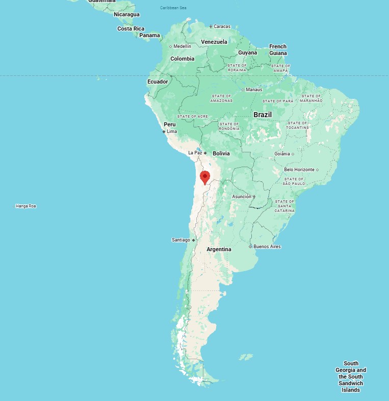
Most visitors fly into Calama Airport (CJC), then drive about 75-90 minutes east to San Pedro de Atacama, the small desert town that serves as the hub for exploring the region.
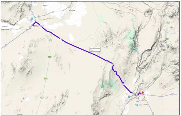
Bill drove while I admired the scenery. At first I found myself wondering, Is this what everyone has been talking about? Mile after mile, there didn’t seem to be much to see except turbine windmills. But before long we were surrounded by wide-open desert, distant volcanoes, and colorful mountains.
Kari Travel Tip: If you’re going to self-cater during your time in the Atacama, stop at Supermercado Líder in Calama before driving to San Pedro. It’s like a big Walmart with tons of food options. Stocking up before we arrived saved us both time and money. Grocery stores in San Pedro are much smaller with more limited selections, and prices tend to be higher.
Once in San Pedro, we recommend shopping at the Valimport Supermarket on B-241, right on the edge of town. It has a small parking lot so you can load up your groceries, rather than carrying them all the way back to the free parking lot.
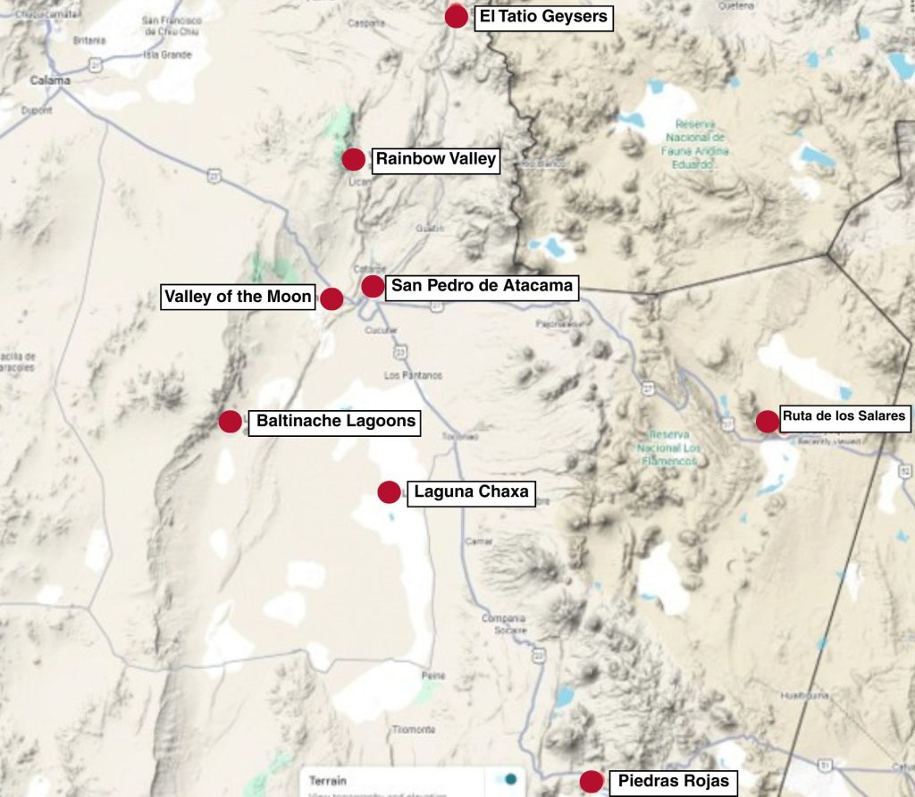
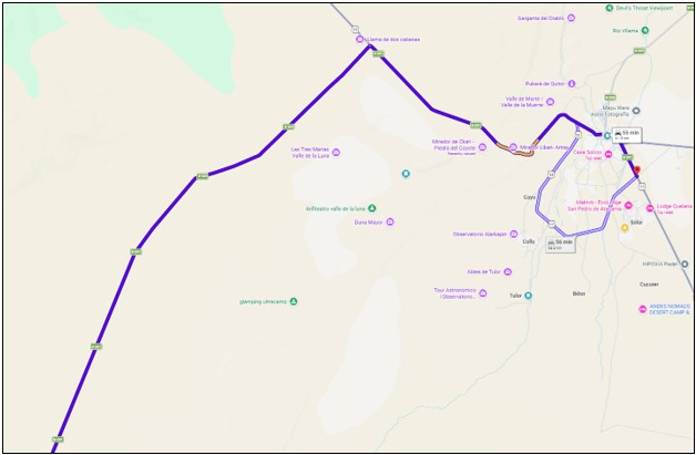
The Atacama Desert map below shows where San Pedro sits within the Atacama Desert relative to all the main destinations and highlights. You can see why San Pedro de Atacama makes such a convenient base for exploring the region.

Understanding the Main Roads Around San Pedro
One of the biggest “aha!” moments of our trip came when I finally understood all the roads leading in and out of San Pedro de Atacama. They twist and turn, share the same roadway for a while, then branch off in different directions. Once I learned how the highways branched out from town, everything finally clicked.
As you follow these roads away from San Pedro, remember you’re exploring a high-altitude desert where elevations change surprisingly quickly. My Atacama Altitude guide contains tips for easing into it and not making any common mistakes.
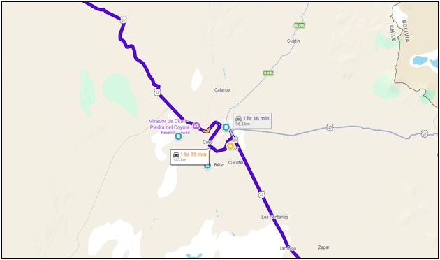
Ruta 23
This paved highway brings you from Calama in the Northwest (where you fly into), comes close to San Pedro de Atacama and for some reason, does a big wide sweep south of town before continuing on South towards Laguna Chaxa, Valle de Jere and Piedras Rojas. It never passes directly through SPdA.
Ruta 27
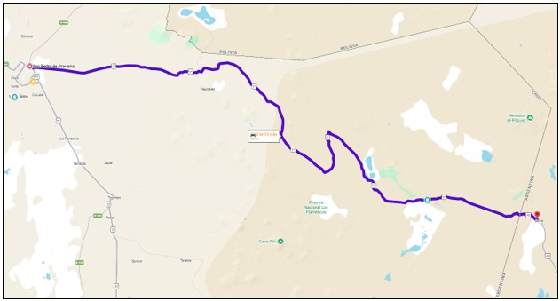
This paved highway leads East out of San Pedro and winds up higher and higher into the desert, passing volcano and salt flat overlooks until it eventually reaches the Argentina border. You’ll also pass by the Bolivia border crossing if you take this route.
Note: You will need specific paperwork from your rental car company to cross either of these borders. We crossed the Chile/Argentina border twice in the Patagonia part of our South America trip, but we did not in the Atacama Desert.
B-245
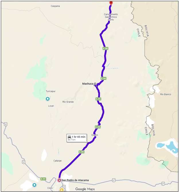
This road starts right in town and leads you northeast out of San Pedro de Atacama up towards Machuca and the El Tatio Geysers.
B-241
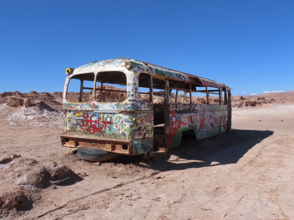
B-241 starts just south of town where Ruta 23 turns south. It runs through the center of San Pedro before joining Ruta 23 for several miles. Eventually, it branches off toward the Magic School Bus and the Hidden Lagoons of Baltinache.
Note: Once it turns off the main highway, it becomes a pretty rough and bumpy road.
B-245 and B-241 Intersection
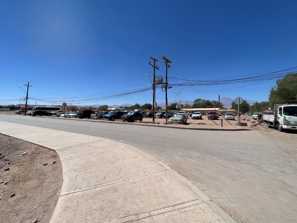
This was the intersection that confused us more than any other during our first few days. These two highways converge and then split into two with only a sidewalk median between them. Signage was unclear – we took the wrong road several times.
The one on the left is B-241 which leads you west out of town. The one on the right is B-245 which takes you up to Machuca and the El Tatio Geysers.
Free Parking in San Pedro de Atacama
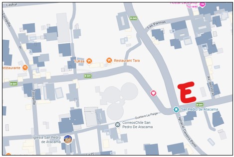
The big E is a large free parking lot for San Pedro de Atacama. After we went the wrong way on some one-way streets or accidentally drove through some Pedestrian only zones, we asked a local where to park. From this spot, you can easily walk into the Central Business District.
In Google Maps, put “Antena de Telefonía Entel.” In Chile, all parking areas are labeled with a large “E” (for estacionamiento) rather than the “P” we see in USA.
Kari’s Travel Tip: Don’t worry if the roads seem confusing at first—they certainly did to us. After a day or two, you’ll start recognizing the major highways and how they connect to San Pedro de Atacama. Before long, you’ll be navigating the Atacama with confidence.

PLAN YOUR TRIP WITH OUR
FAVORITE TOOLS
– Best Lodging site: Booking.com
– Book Day Tours here: Viator.com
– Rent Cars here: DiscoverCars.com
Our 5 Self-Drive Day Trips
Once we understood which highways led to which part of the Atacama, our itinerary practically planned itself. Rather than zigzagging across the desert, we grouped nearby attractions into five logical day trips.
We also intentionally started with the lowest elevations and gradually worked our way higher. The high altitude affected both of us—especially Bill—so we took our time, listened to our bodies, and returned to San Pedro de Atacama whenever we’d had enough. That flexibility was one of the biggest advantages of having a rental car.
#1 – West: Valle de la Luna & the Magic School Bus
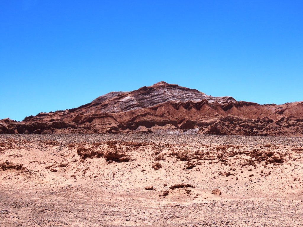
This was our first road trip, so we kept it close to San Pedro. We started by driving through Valle de la Luna, which sits just off Ruta 23 where the highway swings southwest of town in a big loop. Tickets must be purchased online ahead of time. Later, we followed Ruta 23 west and turned south onto B-241 in search of the famous Magic School Bus. We almost gave up looking for it, but eventually found it hidden out in the desert.
That evening, we joined thousands of other visitors at Mirador de Ckari for sunset. To avoid the traffic jam afterward, we left early and ended up watching the final moments of sunset from Ruta 23 on the drive back to our accommodation.
See my full Day Trip #1: West – Valle De La Luna Atacama + Magic Bus Guide for the complete route, photos and all the details.
#2 – South: Laguna Chaxa & Valle de Jere
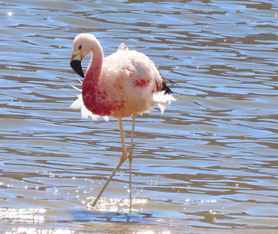
Ruta 23 curves south and becomes the main highway serving the southern Atacama. This is the road you’ll follow to Laguna Chaxa, Valle de Jere, Socaire, and eventually Piedras Rojas.
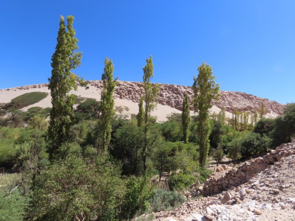
We spent most of a day exploring Laguna Chaxa and Valle de Jere, combining wildlife viewing with one of the greenest and most surprising landscapes we found in the desert. Although many travelers continue on to Piedras Rojas, we chose to spend more time at the lower-elevation stops.
See my full Day Trip #2: South – Laguna Chaxa Flamingos + Valle de Jere Guide for everything you need to know.
#3 – Northwest: Rainbow Valley & Yerbas Buenas Petroglyphs
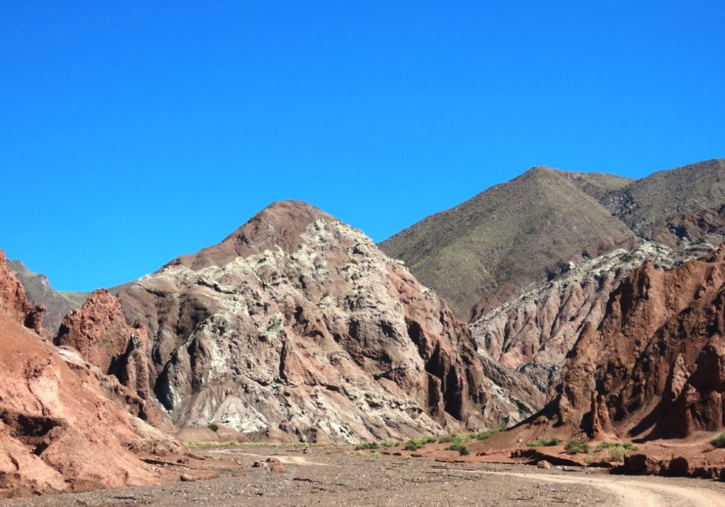
From San Pedro, B-207 branches off Ruta 23 northwest toward Yerbas Buenas, Rainbow Valley, and eventually the small village of Río Grande. Compared with some of the Atacama’s more famous routes, this drive felt far quieter and less visited.
We followed B-207 all the way to Río Grande and were rewarded with colorful rock formations, ancient petroglyphs, and our very first cactus sighting of the trip. It turned out to be one of the most enjoyable surprises of our time in the Atacama.
See my Northwest: Rainbow Valley & Yerbas Buenas Petroglyphs Day Trip Guide for the complete route, including the completely unlabeled left turn – Bill kept saying “Are you sure this is really a road?”
#4 – North: Machuca & Vado Río Putana
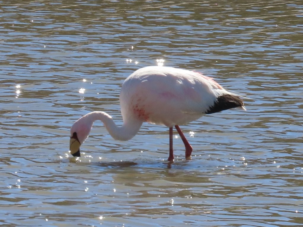
B-245 heads north from San Pedro through Machuca and toward El Tatio Geysers. Along the way, you’ll pass the Flamingos Lagoon (where we saw all three types of Flamingos), the Machuca Wetlands and Vado Río Putana, three of our favorite wildlife-viewing locations in the Atacama Desert.
This is also one of the highest drives in the region, eventually climbing above 14,000 feet. We chose not to continue all the way to El Tatio, instead turning around after visiting the wetlands and Vado Río Putana. The altitude was already affecting us, and after hearing about the conditions farther up from our friends Karen and Peter, we decided not to push our luck.
See my North: Machuca & Vado Río Putana Day Trip Guide for the complete route and stops.
#5 – East: Ruta de los Salares
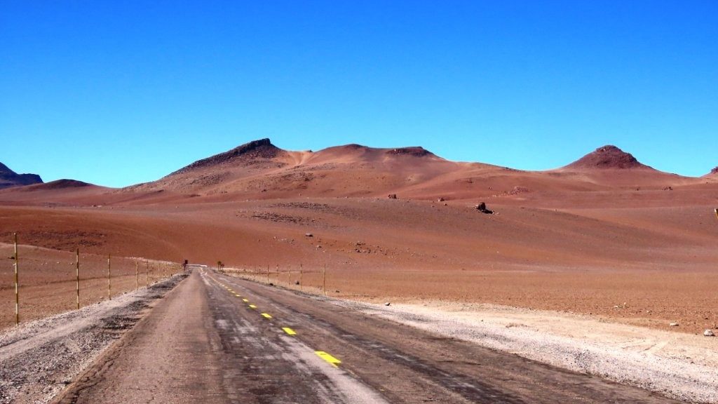
Of all the roads we drove, Ruta 27 was my favorite. The highway climbs steadily into the Andes, passing colorful mountains, volcanoes, salt flats, and high-altitude lagoons on its way toward the Argentine border.
Along the way, you’ll pass many of the highlights that make up the Ruta de los Salares, including Mirador Salar de Loyoques, Laguna Diamante, and Quebrada Quepiaco. We followed Ruta 27 almost all the way to Argentina before turning around because our rental car wasn’t authorized to cross the border.
See my East – Ruta de los Salares day trip guide for the complete route.
Kari’s Self-Driving Tips
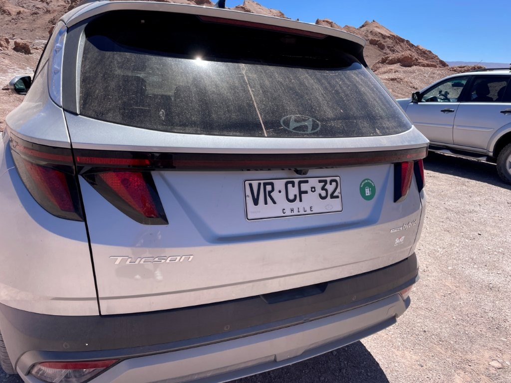
Bill and I rented a Hyundai Tucson 4WD SUV in Calama for our 17 day adventure, and for the places we visited, it worked perfectly and we never wished for a larger vehicle. Most of the main highways were paved and in very good condition.
A few of the access roads to viewpoints and attractions were rougher, but we never encountered anything that required serious off-road driving. We appreciated the extra clearance when we crossed shallow streams near Rainbow Valley and explored a few rough side roads.
A few things made our trip much easier:
- Fill your gas tank every time you leave San Pedro. There is only one gas station in town (COPEC, at the corner of B-241 and Ruta 27), and once you’re out exploring, there are no other gas stations until you get all the way back to Calama. The attendants pump the gas for you, and we had no trouble paying with a credit card.
- Have one person drive, the other person navigate. That saved us a bunch of missed turns, even when using Google Maps on Apple Car Play. The driver needs to keep their eyes on the road instead of the screen.
- Pack water, snacks, and anything else you’ll need for the day. Outside of San Pedro, there are very few services or stores. I always carry toilet paper with me too as there were not bathrooms at many of the places we stopped.
- Download Google Maps for offline use before you leave the WiFi of your accommodation. Cell service disappeared completely for us on several drives, including around Río Grande and even occasionally in San Pedro itself.
- Group attractions by highway rather than driving back and forth across the desert. That’s exactly how we planned our five day trips, and it made every day much more efficient.
- Start with the lower-elevation drives and work your way higher over several days. We noticed the altitude much more above about 13,000 feet, especially on the roads toward El Tatio and Ruta 27. Bill was affected even more than I was, so taking it slowly made a big difference. Here’s our guide for how to survive the high Atacama Desert Altitude.
- Build extra time into your day. We found ourselves stopping constantly for viewpoints, wildlife, and scenery that wasn’t even on our itinerary. Some of our favorite photos came from unplanned roadside stops.
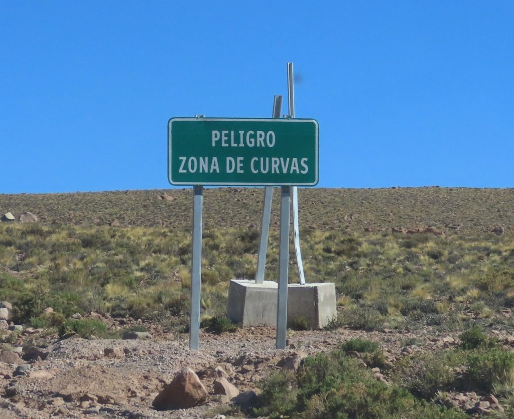
Reading Chilean Road Signs
Most road signs are easy to understand even if you don’t speak Spanish, but knowing a few common words can make driving feel less intimidating.
- Ruta = Highway or Route
- Salida = Exit
- Ceda el paso = Yield
- Uni Via / Doble Via = One Way / Two Way
- Norte / Sur / Este / Oeste = North / South / East / West
- Zona de remolque = Tow-away Zone
- Curvas peligrosas = Dangerous curves
- Reducir velocidad = Reduce speed
- Precaución = Caution
- Advertencia = Warning
- Baños = Restrooms
- Mirador = Scenic viewpoint
Once you’ve seen these a few times, navigating the Atacama becomes much less intimidating—and before long, you’ll be reading the signs without even thinking about them.
Final Thoughts Using an Atacama Desert Map
Before our trip, I spent hours looking at maps of the Atacama Desert, trying to figure out where everything was and how it all fit together. It wasn’t until we started driving that it finally clicked. Once I understood the main highways leading out of San Pedro de Atacama, each day’s drive fell naturally into place.
If you’re renting a car, I hope this guide helps you skip that learning curve. Instead of feeling overwhelmed by a long list of attractions, you’ll know which roads to take, how to group nearby sights together, and where to focus each day’s adventure.
The Atacama Desert is one of the most spectacular places Bill and I have ever explored. Whether you’re chasing flamingos, colorful mountains, dramatic salt flats, or unforgettable sunsets, having a good map—and a little flexibility—will help you experience the very best of this incredible corner of Chile.
More Atacama Desert Travel Guides
Here are some more guides about visiting the Atacama Desert and Chile. If you’d like to receive emails when I’ve posted new content to the site, please complete the short form above.
Visit the Atacama Desert: A Self-Drive Guide
Atacama Desert Tours: How to Explore It Without Driving
Atacama Desert Map: Explore The Desert, One Road At A Time
Atacama Desert Altitude – How To Keep It From Ruining Your Trip
Atacama Desert Night Sky: How to Experience the Stars
Atacama Desert Animals: What You Can See & Where
Where to Stay in the Atacama Desert: My Top Hotel Picks for Every Budget
Day Trip #1 – West: Valle De La Luna Atacama + Magic Bus + Ckari Sunset
Day Trip #2 – South: Laguna Chaxa Flamingos + Valle de Jere
Day Trip #3 – Northwest: Rainbow Valley Atacama + Petroglifos Yerbas Buenas
Day Trip #4 – North: Machuca Wetlands + Vado Rio Putana
Day Trip #5 – East: Ruta de los Salares
