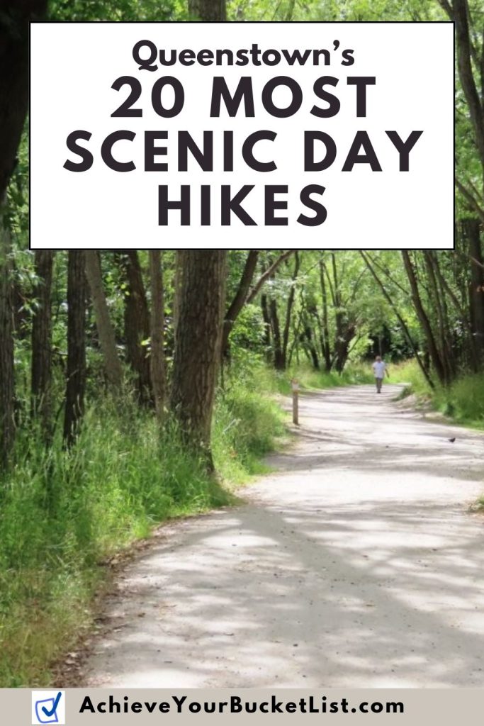
Looking for the best hikes in Queenstown? Here are the top trails, sorted by easy, moderate, and challenging.
Trying to decide which hikes in Queenstown are actually worth your time? This guide rounds up the best day hikes near Queenstown, from easy lakeside walks to steep mountain climbs, so you can quickly find the right trail for your schedule and fitness level.
During our two months on New Zealand’s South Island, Bill and I explored trails all around the Queenstown area, from short waterfront paths to bigger alpine hikes. I’ve pulled together the most popular options here, with practical details to help you choose the best fit.
If you want mountain views, lake walks, or a real hiking challenge, these Queenstown hikes deliver.

Quick picks for hikes in Queenstown
- Best easy walk: Queenstown Gardens Loop
- Best lakeside walk: Frankton Arm Walkway
- Best half-day hike: Moke Lake Loop Track
- Best summit challenge: Ben Lomond Track
- Best nearby scenic stop: Bennetts Bluff Viewpoint Walk
- Best hike near Arrowtown: Arrow River Bridges Trail
Best Easy Hikes in Queenstown
These easy hikes in Queenstown are best for travelers who want beautiful scenery without a huge time or fitness commitment.
#1 Arawata Bridle Track
Distance / time: A little under 1 mile each way; about 45 minutes one way
Why go: This is a short, easy walk with good views of Lake Wakatipu and a bit of local history, following the original bridle trail that once connected Glenorchy and Queenstown.
Good to know: Starts at the bend of Arawata Terrace and ends near 5 Mile Creek on Glenorchy Road.
Directions to Trailhead: Open in Google Maps – More Info
#2 Arrow River Bridges Trail
Distance / time: Just over 2.5 miles round trip; about 1 hour
Why go: This is a pleasant riverside stroll near Arrowtown and a nice choice if you want an easy walk in a pretty setting.
Good to know: This track connects with several other trails and is also popular with bikers, so keep an eye out.
Directions to Trailhead: Open in Google Maps – More Info

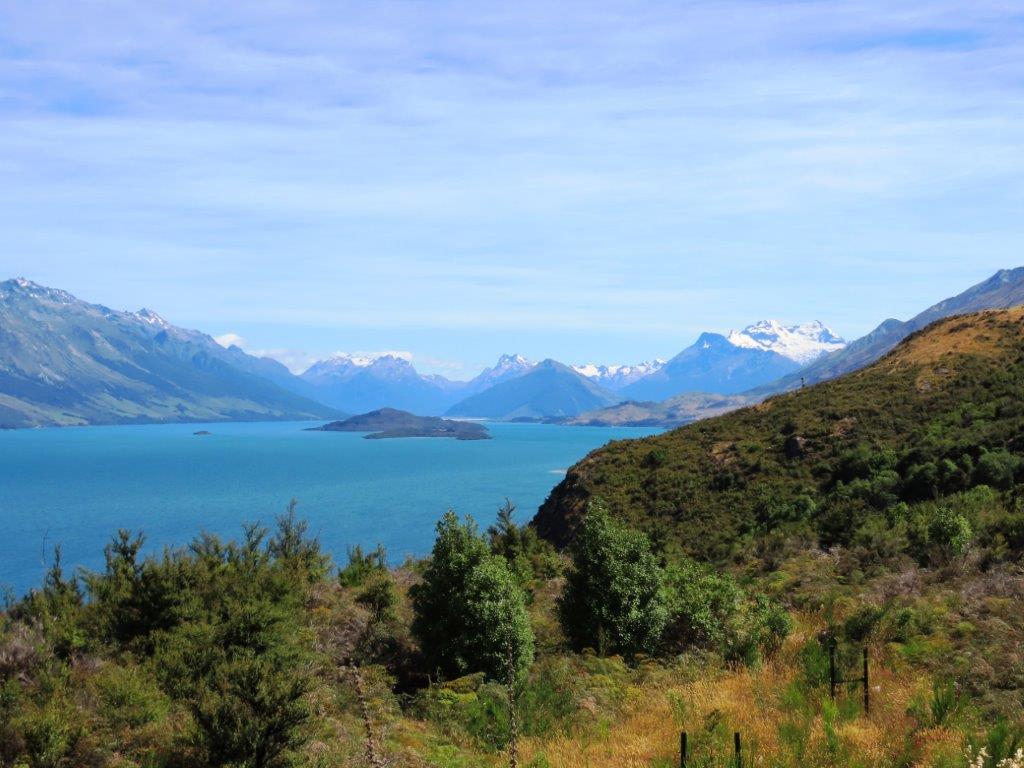
#3 – Bennetts Bluff Viewpoint Walk
Distance / time: About 15 minutes
Why go: If you want a short walk with a big payoff, Bennetts Bluff delivers beautiful views of Lake Wakatipu and the surrounding mountain ranges. My camera was snapping non-stop here!
Good to know: The parking area is about 15 miles from Queenstown on the road to Glenorchy. The trail has a gradual incline and is wheelchair accessible.
Directions to Trailhead: Open in Google Maps – More Info
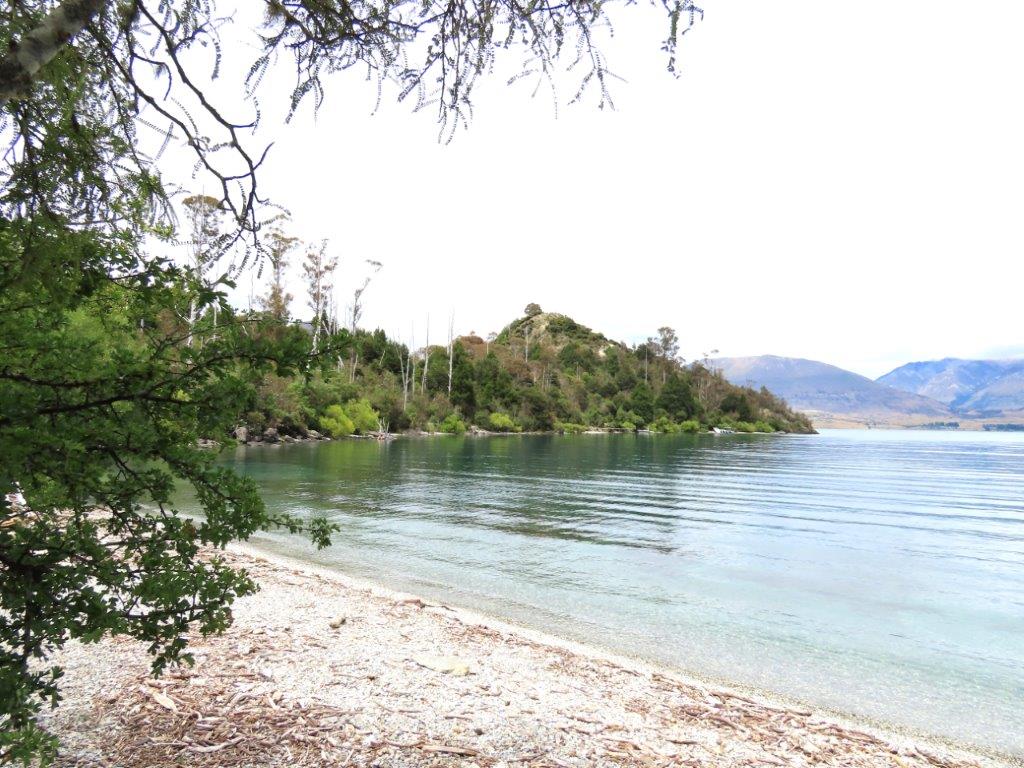
#4 – Bob’s Cove Track & Nature Walk
Distance / time: About 20 minutes to reach the cove. We spent about 1 hour exploring the area and the adjacent trails.
Why go: This is a lovely short walk to a secluded cove on Lake Wakatipu, with extra little paths and birdwatching opportunities once you get there.
Good to know: The trailhead is about 9 miles from Queenstown on the Glenorchy Road, and parking is limited.
Directions to Trailhead: Open in Google Maps – More Info
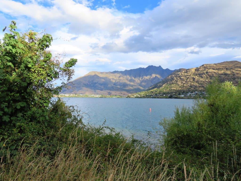
#5 – Frankton Arm Walkway
Distance / time: 4 miles one way; about 2–3 hours round trip
Why go: This mostly flat lakeside path is one of the most accessible hikes in Queenstown and offers beautiful views of the lake, the Frankton Peninsula, and The Remarkables. Also great for sunset watching! Our accommodation was right by the trail, so we walked it almost every day.
Good to know: Runs from Queenstown Gardens to Frankton along the edge of Lake Wakatipu. I would park at either Queenstown Gardens or at Frankton Beach
Directions to Trailhead: Open in Google Maps – More Info

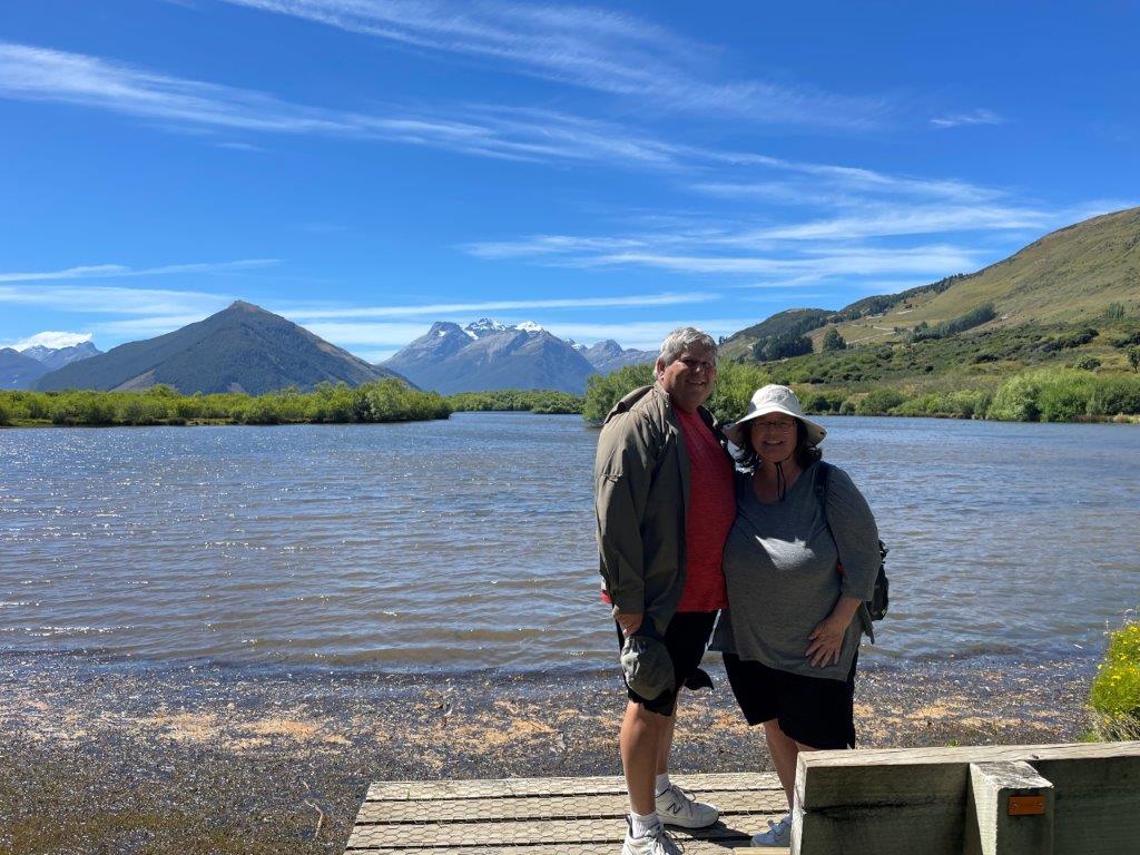
#6 – Glenorchy Lagoon Walkway
Distance / time: 3 mile loop trail, about 60-90 minutes, 160 foot elevation gain
Why go: This flat boardwalk walk through wetlands is a great choice for birdwatchers and anyone who loves mountain scenery. Bill and I spent several hours wandering the trails and looking for birds, especially the black swans.
Good to know: Starts at the Glenorchy Wharf and follows boardwalks through the wetlands. Located about 45 minutes from Queenstown in the town of Glenorchy.
Directions to Trailhead: Open in Google Maps – More Info

#7 – Moke Lake Loop Track
Distance / time: 4.3 miles loop; 2–3 hours
Why go: This scenic loop around Moke Lake is one of the most popular easy hikes near Queenstown, with mountain views all around.
Good to know: The turnoff for Moke Lake Road is about 8 miles from Queenstown on the Glenorchy Road. The final 8 miles are on a rough gravel road, but the effort to get there is worth it.
Directions to Trailhead: Open in Google Maps – More Info

#8 – Queenstown Gardens Loop
Distance / time: 1.2 miles; about 24 minutes
Why go: This is an easy walk right on the waterfront in downtown Queenstown and a nice option if you want something quick, scenic, and close to town.
Good to know: It can easily take longer if you stop to enjoy the flowers and lake views.
Directions to Trailhead: Open in Google Maps – More Info
#9 – Seven Mile Track / Wilson Bay Track
Distance / time: 2 miles; about 1 hour total, 30 minutes each way
Why go: This easy lakeside track loosely follows the shoreline of Lake Wakatipu and makes a peaceful outing close to Queenstown.
Good to know: Starts about 4 miles south of Queenstown along the Glenorchy Road. Parking can be busy in summer at both ends.
Directions to Trailhead: Open in Google Maps – More Info


#10 – Sunshine Bay Track
Distance / time: 2.5 miles; about 1 hour
Why go: This quieter trail combines lakeshore walking with a short climb to cliff views over Lake Wakatipu and Queenstown.
Good to know: The trailhead is about 5 minutes from Queenstown on the road toward Glenorchy.
Directions to Trailhead: Open in Google Maps – More Info
Best Moderate Hikes in Queenstown
These moderate hikes in Queenstown are a great fit for travelers who want bigger views and a little more challenge, but do not necessarily want an all-day sufferfest.
#11 – Sawpit Gully Trail
Distance / time: 5 miles round trip; about 3 hours
Why go: This is a moderate Arrowtown hike with a bit more elevation and a more substantial workout than the easy walks above.
Good to know: About 1,351 feet of elevation gain. Start at the Buckingham Car Park in Arrowtown, near the Historic Chinese Settlement Village.
Directions to Trailhead: Open in Google Maps – More Info
#12 – Jack’s Point Track
Distance / time: 8.7 miles round trip; a little over 4 hours
Why go: This longer moderate track southeast of Queenstown offers stunning mountain and lake views as it winds along Lake Wakatipu.
Good to know: About 1,532 feet of elevation gain. Runs from Jack’s Point to Jardine Park.
Directions to Trailhead: Open in Google Maps – More Info
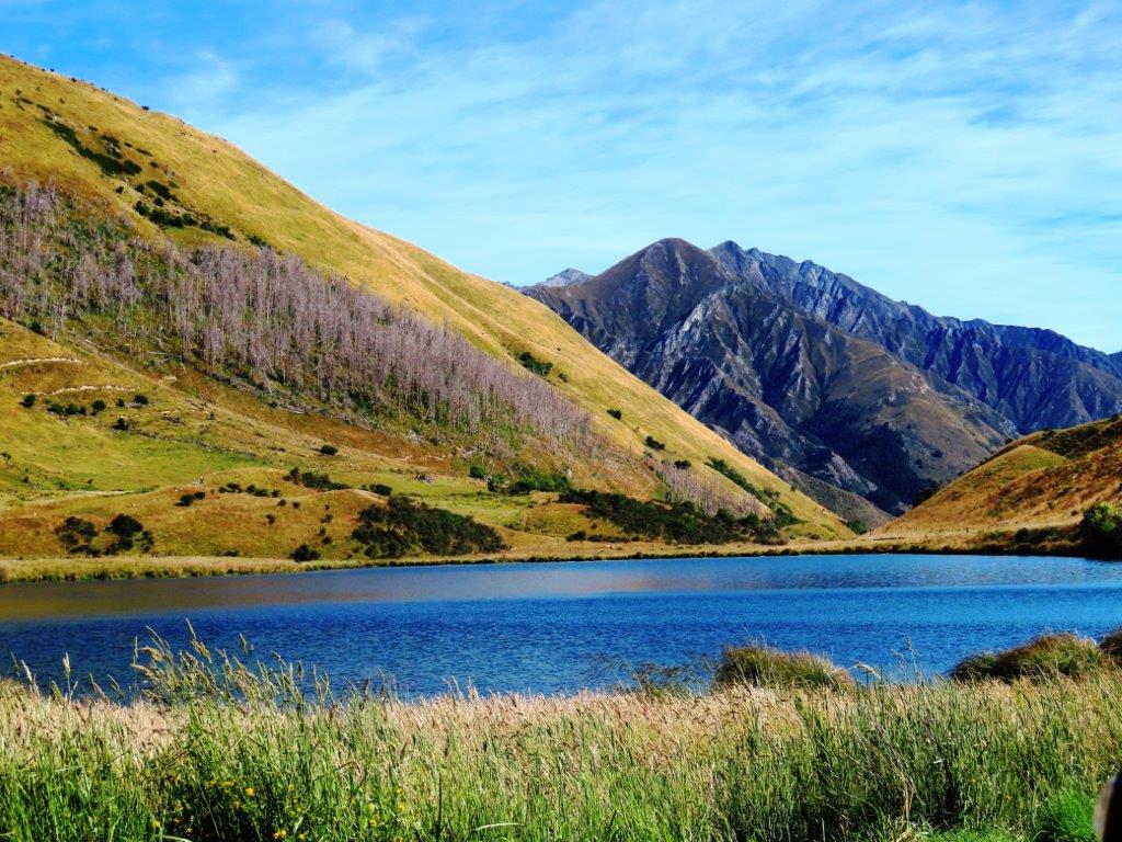
#13 – Lake Alta Track
Distance / time: 2.1 miles round trip; about 80–90 minutes
Why go: This alpine track south of Queenstown leads to Lake Alta and is a good option if you want mountain scenery without committing to a full-day hike.
Good to know: About 679 feet of elevation gain. Begins at The Remarkables ski field buildings.
Directions to Trailhead: Open in Google Maps – More Info
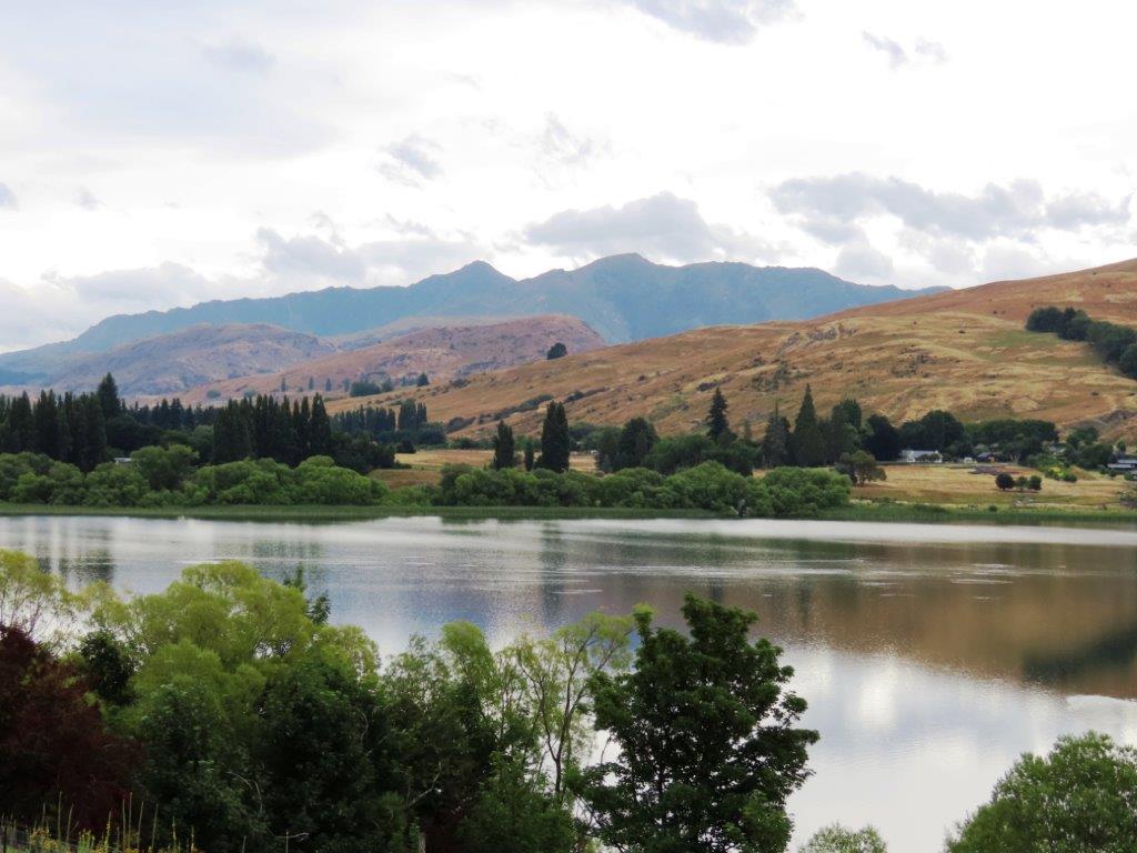
#14 – Lake Hayes Walkway
Distance / time: 4.9 miles loop; 2–3 hours
Why go: This popular lake loop is a nice moderate walk if you want pretty scenery and a well-loved local trail. We saw the California Quail here – such a beautiful and interesting bird!
Good to know: About 475 feet of elevation gain. Starts at the Lake Hayes Picnic Area about 15 minutes east of Queenstown.
Directions to Trailhead: Open in Google Maps – More Info

#15 – One Mile Creek Walk
Distance / time: 1.6 miles round trip; about 75 minutes
Why go: This creekside hike is a good moderate option close to town, with a small waterfall at the end. AllTrails says it is also a good place to see glowworms at night!
Good to know: About 708 feet of elevation gain. Park at the One Mile Car Park and head towards the One Mile Powerhouse, following the orange markers.
Directions to Trailhead: Open in Google Maps – More Info
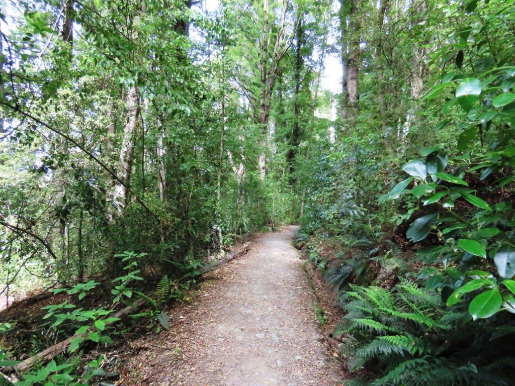
#16 – Mt Crichton Loop Track
Distance / time: About 5 miles loop; about 2.5 hours
Why go: This beautiful forest hike adds a bit of local history to the scenery, with interpretive signage along the way.
Good to know: About 1,000 feet of elevation gain. Trailhead is about 15 minutes west of town on the Glenorchy-Queenstown Road, just past 12 Mile Delta.
After parking, head west out of the parking lot on the Bob’s Cove Trail, but turn right at the T in the trail, cross the road and then begin the Mt Crichton Loop Track.
Directions to Trailhead: Open in Google Maps – More Info

Best Challenging Hikes in Queenstown
These challenging hikes in Queenstown are best for strong hikers who want steep climbs, longer distances, and the kind of views that make your legs forgive you later.
#17 – Ben Lomond Track
Distance / time: 9 miles full hike; 6.5 miles if you take the Skyline gondola up first. This is a full-day hike.
Why go: This is one of the classic challenging hikes in Queenstown, with huge views and a real sense of accomplishment at the top.
Good to know: About 4,700 feet of elevation gain. Starts from several points in Queenstown, most commonly via the #20 Tiki Track from the end of Brecon Street. Or take the Skyline Gondola up to Bob’s Peak to save 2.5 miles and lots of elevation.
Several steep mountain bike trails intersect with this trail. Watch out for high-speed bikes crossing the path.
Directions to Trailhead: Open in Google Maps – More Info
#18 – Queenstown Hill Walkway
Distance / time: 3 miles; about 2–3 hours
Why go: This very popular trail leaves right from town and rewards the climb with wide views over Queenstown and the surrounding mountains.
Good to know: About 1,309 feet of elevation gain. Starts from Belfast Street in downtown Queenstown.
Note: I’ve seen this hike ranked as easy, moderate, and challenging, so if you do it, reach out and let me know how hard it felt to you.
Directions to Trailhead: Open in Google Maps – More Info
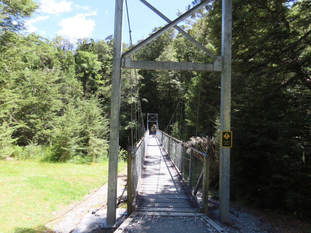
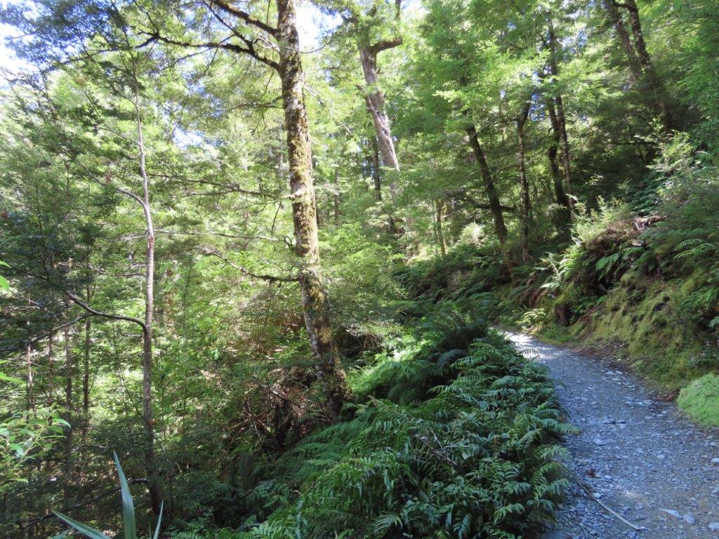
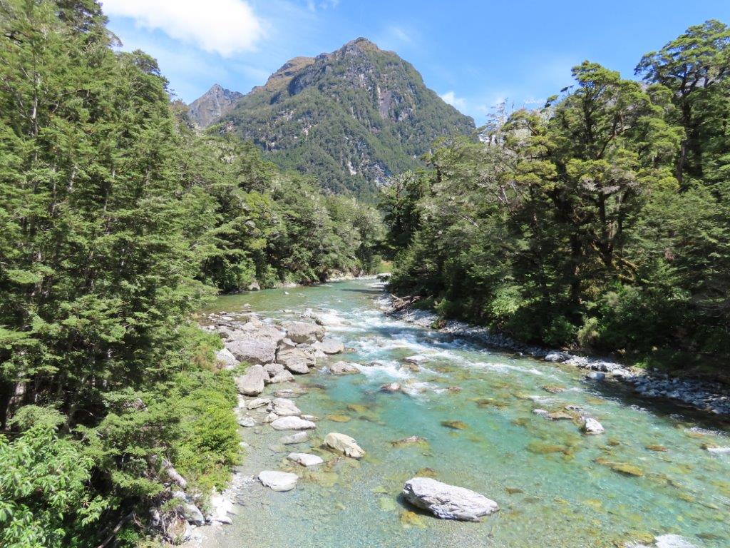
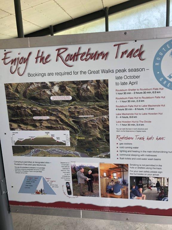
#19 – Routeburn Track
Distance / time: Full track is over 20 miles and takes 3–4 days; partial day hikes are possible
Why go: The Routeburn is one of New Zealand’s famous 10 Great Walks and a Bucket List trail for many hikers.
Good to know: About 4,878 feet of elevation gain. Huts and campsites require reservations and can book out months in advance. One end starts near the Routeburn Shelter north of Glenorchy. The other end is near Milford Sound.
Personal note: We only did a small portion of it as a day hike, walking along the Nature Trail from the Routeburn Shelter before turning around.
Directions to Trailhead: Open in Google Maps – More Info
#20 – Tiki Track
Distance / time: 2.8 miles; about 2.5 hours
Why go: This steep climb is a good challenge on its own and also serves as the first section of the Ben Lomond Track.
Good to know: About 1,440 feet of elevation gain. Starts at the Skyline Gondola station near the end of Brecon Street.
Directions to Trailhead: Open in Google Maps – More Info
About the New Zealand Great Walks
Lots of people come to New Zealand to do big multi-day tracks (called treks) through the mountains. Visit the Department of Conservation site to learn more about the 10 Great Walks of New Zealand, where they are located, and how to book one. Reservations for these can be tough to get so reserve as early as you can!
More Day Hikes in the Queenstown Area
Conclusion: Day Hikes in Queenstown
If you love mountain views, lakeside walks, and getting out into nature, the hikes in Queenstown really deliver. One of the things Bill and I loved most about our time here was how easy it was to find beautiful tracks just minutes from town.
Whether you’re looking for a gentle stroll, a half-day adventure, or a leg-burning climb with huge views, there’s truly a Queenstown hike for every kind of traveler.
I hope this guide helps you find the right trail for your trip and inspires you to spend a little more time outdoors while you’re here. Lace up your shoes, pack some water and a snack, and enjoy every step. Happy hiking!
More New Zealand Posts
Here are some more posts about New Zealand, including some that I’m still working on. If you’d like to receive emails when I’ve posted new content to the site, please complete the short form above.
- New Zealand Overview – Facts & Travel Tips for First Time Visitors – the currency, time zone, driving, language, drinking water and more
- Why the South Island was Perfect for our New Zealand Road Trip
- Safe Driving In New Zealand – 10 Things You Need to Know
- Lots more posts coming soon!
Queenstown
- 20 Best Hikes in Queenstown, New Zealand
- 28 Popular Things to Do in Queenstown, New Zealand
- More coming soon!
Kaikoura
- 23 Best Things to Do in Kaikoura, NZ
- Tips for Exploring the Kaikoura Peninsula & Walkway
- Coming Soon: Experiencing the Albatross Encounter
Lake Tekapo
- Lake Tekapo Stargazing – Where to Stay to See the Stars for FREE
- More Coming Soon!
Find this post helpful? Save it to Pinterest for later!